The ruins of the monastery are open to visitors
MonasteryBois-de-Céné
Abbaye de l'Île-Chauvet
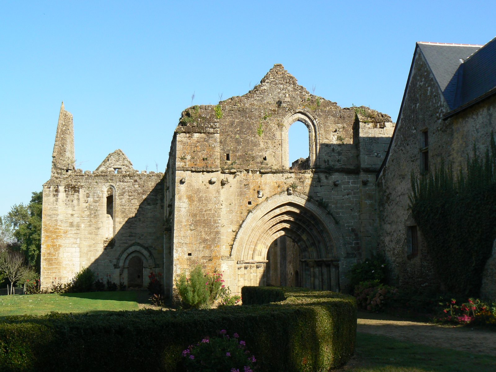
The Abbaye de l'Île-Chauvet, a former monastery, is located in Bois-de-Céné in the Vendée department, Pays de la Loire region, France. Once situated on an island in the Breton marsh, it marked the historical border between Brittany and Poitou and is now a ruin.
History+
Around 1130, the abbey was founded by Benedictine monks from Absie Abbey, who were called to the region by Pierre II de La Garnache to cultivate the salt marshes. The monks followed a strict Benedictine rule, close to the Cistercian tradition. The oldest surviving parts, such as the choir, date from the second half of the 12th century. The nave was completed around the mid-13th century, and the convent buildings, including the current refectory wing, also largely originated in the 13th century. In the 17th century, these were converted for a Camaldolese community. The abbey suffered multiple destructions: it was plundered in 1381 during the Hundred Years' War and burned down in 1588. After being occupied by Benjamin de Rohan until 1622, the last Benedictine monk left the monastery in 1625. Following unsuccessful attempts to revive the Benedictine order, Camaldolese monks settled there in 1679. In 1791, the abbey was sold as national property and acquired in 1828 by the Guillet de La Brosse family, who still own it today. The ruins of the church, two 12th-century structures, the Gothic fountain, and the cloister floors were declared a Monument historique in 1992.
Location+
The Abbaye de l'Île-Chauvet is located in Bois-de-Céné in the Vendée department, Pays de la Loire region, France, at an elevation of approximately 6 m above sea level.
On site+
The remains of the monastery are now accessible to visitors. The complex remains private property and is occasionally used for cultural events.
Take Mobile History with you
You are reading this text for free. Premium adds what matters on the road: descriptions read aloud, sites found through your camera, whole regions taken offline.
- Every description, including the ~17,700 Premium sites
- Audio guide: have descriptions read to you on location
- AR finder: see sites through your camera, with distance and bearing
- Unlimited saved sites
14 days free, then from €2.99 a month. Cancel anytime.
Source: Wikipedia · Licence: CC BY-SA 4.0 · Image: Antoine Meissonnier · Wikimedia Commons · CC BY-SA 4.0
This description draws on the facts documented in the linked Wikipedia article; Wikipedia content is licensed under CC BY-SA 4.0. Wording and editing: Mobile History.
Location: 46.9333, -1.9092