To be privately owned
MonasteryChâteau-d'Olonne
Abbaye Saint-Jean d'Orbestier
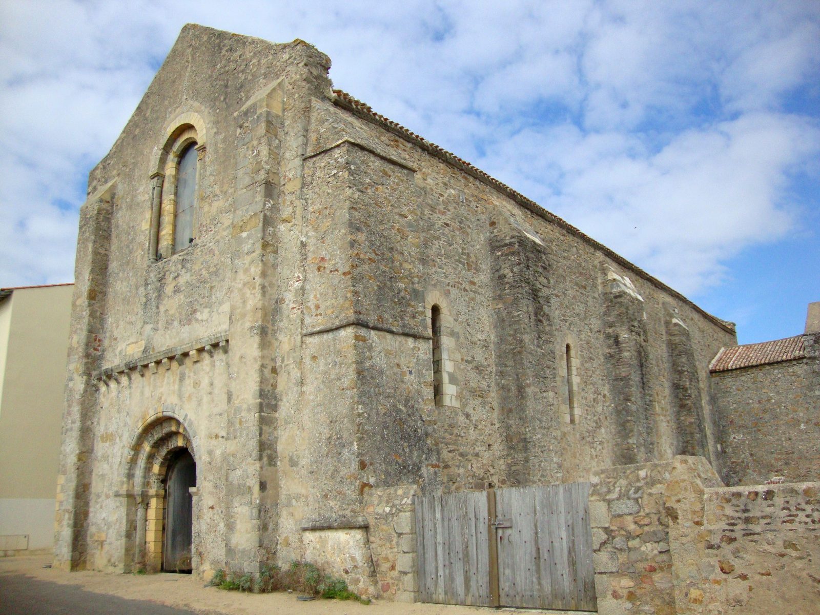
The Abbaye Saint-Jean d’Orbestier is a former Benedictine abbey located in Le Château-d’Olonne (now part of the commune of Les Sables-d’Olonne), in the Vendée department of the Pays de la Loire region in western France, close to the Atlantic coast.
It was founded in July 1107 by Guillaume IX, Duke of Aquitaine and Count of Poitou, who authorised Benedictine monks to establish a monastery dedicated to Saint John the Baptist and the Virgin Mary in the large forest of Orbestier (the name deriving from a Latin root meaning roughly “end of the world”). The original domain covered several hundred hectares. In 1181 Richard the Lionheart confirmed the monks’ privileges after they complained of usurpations by Raoul III de Mauléon and used the forest of Orbestier as one of his favourite hunting grounds.
The abbey suffered repeated destruction: a major fire in 1251, pillage by the English in 1340 during the Hundred Years’ War, and burning and looting by Protestants in 1568–1569 during the Wars of Religion. Many of the remaining monks abandoned the religious life. From the 17th century the abbey was in decline; its temporal possessions were farmed out from 1659, and the monastery was formally suppressed in 1769, its revenues being attached to the cathedral of Luçon. After the French Revolution the buildings and lands were sold as national property and used for agriculture. The church later served as a navigational landmark for shipping; the vault of the nave collapsed between 1896 and 1912. From 1934 to 1989 the site housed a preventorium and then a special-needs school.
In 1989 the municipality acquired the abbey and began a long-term restoration programme. Surviving elements include the ruins of the abbey church (with an inverted plan — church to the south, cloister to the north), the abbot’s lodgings, the Tour de la Gloriette and a dovecote. The principal remains were inscribed as a Monument historique on 28 January 1935. Recent works have included the demolition of modern school buildings in order to reopen views of the historic structures. The site is normally open only for cultural events and guided visits.
Take Mobile History with you
You are reading this text for free. Premium adds what matters on the road: descriptions read aloud, sites found through your camera, whole regions taken offline.
- Every description, including the ~17,700 Premium sites
- Audio guide: have descriptions read to you on location
- AR finder: see sites through your camera, with distance and bearing
- Unlimited saved sites
14 days free, then from €2.99 a month. Cancel anytime.
Source: Wikipedia · Licence: CC BY-SA 4.0 · Image: Spouik · Wikimedia Commons · CC BY-SA 3.0
This description draws on the facts documented in the linked Wikipedia article; Wikipedia content is licensed under CC BY-SA 4.0. Wording and editing: Mobile History.
Location: 46.4682, -1.7303