The remains of the castle can be visited
CastleJülich - Altenburg
Motte Altenburg
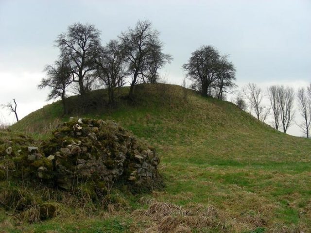
The Motte Altenburg in Jülich is the ruin of a motte-and-bailey castle. Of the original complex, the earth mound and remnants of the moat remain.
History+
The Motte Altenburg originated in the 12th century, when the County of Jülich strengthened its fortifications to assert itself against the Archbishopric of Cologne. It is believed that the complex was intended to secure the Rur line and restrict the movement of enemy armies. It may also have served as the ancestral seat of the Counts of Jülich. The fortification likely consisted of an artificial castle mound supporting a wooden or stone tower, surrounded by a bailey with palisades and earthworks. Minor wall remains suggest a stone curtain wall, partly constructed from Roman bricks. During excavations in 1896, a well with tuff casing was discovered. Topographical maps from the early 19th century show a double moat, which is now silted up. The motte was probably destroyed in the 13th century during conflicts with the archbishop and not rebuilt, possibly in 1239 or 1278.
Location+
The ruin of Motte Altenburg is located in the Altenburg district of the city of Jülich, in the Düren district, North Rhine-Westphalia, Germany.
On site+
Today, the remains of the ruin are preserved as an archaeological monument and can be visited. The tree-covered earth mound and traces of the former moat are still visible.
Take Mobile History with you
You are reading this text for free. Premium adds what matters on the road: descriptions read aloud, sites found through your camera, whole regions taken offline.
- Every description, including the ~17,700 Premium sites
- Audio guide: have descriptions read to you on location
- AR finder: see sites through your camera, with distance and bearing
- Unlimited saved sites
14 days free, then from €2.99 a month. Cancel anytime.
Source: Wikipedia · Licence: CC BY-SA 4.0 · Image: http://de.wikipedia.org/wiki/Datei:Motte-Altenburg.jpg
This description draws on the facts documented in the linked Wikipedia article; Wikipedia content is licensed under CC BY-SA 4.0. Wording and editing: Mobile History.
Location: 50.8919, 6.3874