The remains of the ancient town can be visited
Ancient BuildingPliska (Плиска)
Ancient city Pliska (Плиска)
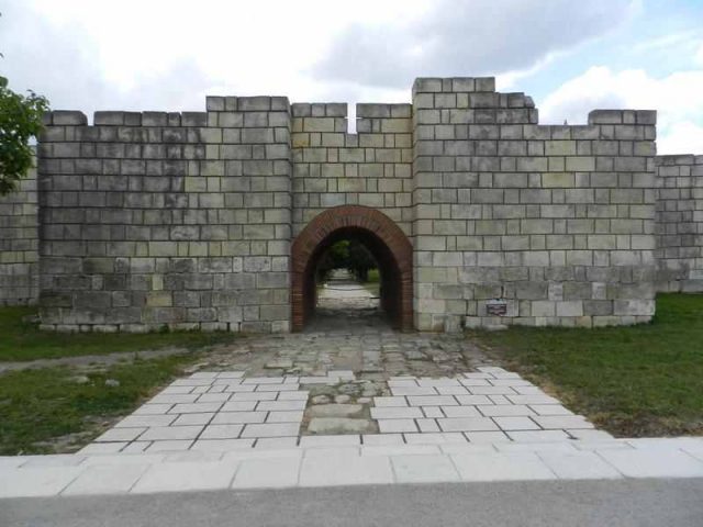
In Bulgaria, the ancient city of Pliska was once the first capital of the First Bulgarian Empire. Its remains, located on a plain near the modern town of Pliska, served as a center of power from 681 to 893 AD.
History+
Pliska was founded at the end of the 7th century by the Proto-Bulgarians, who chose the site for its favorable conditions for livestock breeding and its location on important trade routes. Initially, the buildings were made of wood, including round and square structures for residential and representative purposes, surrounded by fortifications and settlements for the common people. By the end of the 8th century, wooden structures were replaced by stone buildings, with the Krum Palace presumably among the first. In 811, the capital was burned down by the Byzantine Emperor Nikephoros I. Under Omurtag (814–83), the palace center was rebuilt, with a new throne room erected on the site of the destroyed Krum Palace and the center surrounded by a stone wall. After the adoption of Christianity as the state religion in 864 under Prince Boris I, Pliska transformed; pagan cult sites were converted into Christian places of worship, and new churches were built. In 893, the capital was moved to Preslav, and Pliska lost its political significance but developed into an economic center. The city's decline began with the Pecheneg invasion in 1048-49.
Location+
The ancient city of Pliska is located in Bulgaria, in the Shumen district, near the town of Kaspichan and the modern settlement of Pliska. The site is situated at an elevation of approximately 172 meters above sea level.
On site+
Visitors can explore the remains of the ancient city of Pliska. These include the East Gate, which once served as the main entrance to the fortress, as well as the ruins of the Throne Palace, also known as the Omurtag Palace, and those of the so-called “Small Palace”. Walls made of large hewn blocks, baths, water pipes, and water reservoirs are visible throughout the site. In the northeastern part of the fortress, there is a museum displaying archaeological finds from the area.
Take Mobile History with you
You are reading this text for free. Premium adds what matters on the road: descriptions read aloud, sites found through your camera, whole regions taken offline.
- Every description, including the ~17,700 Premium sites
- Audio guide: have descriptions read to you on location
- AR finder: see sites through your camera, with distance and bearing
- Unlimited saved sites
14 days free, then from €2.99 a month. Cancel anytime.
Source: bulgariatravel.org · Image: http://www.wehrbauten.de
Text and/or image for this object come from the linked site and are used with the permission of its operators; the linked page remains the copyright of its authors. The legacy catalogue kept text source and image source in a single field, so which part came from there can no longer be told apart entry by entry.
Location: 43.3873, 27.1313