The remains of the castle can be visited
CastleEhingen - Briel
Briel Castle
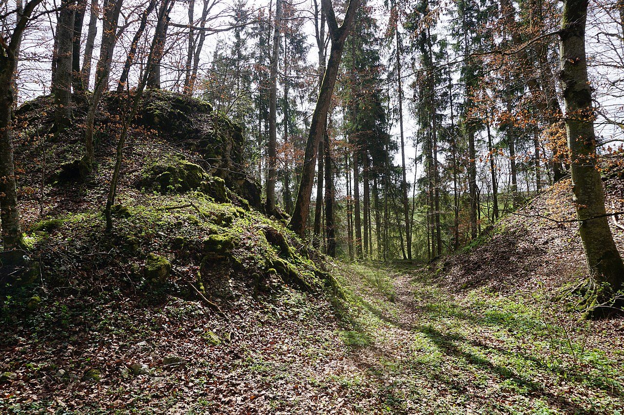
The Briel ruin, also called Brielburg, Harscherburg or correctly Altsteußlingen, is a ruined spur castle on a conical 648 m above sea level high mountain spur east of the hamlet of Briel, northwest of the city of Ehingen in the Tübingen Alb-Donau district in Baden-Württemberg.
History+
The Lords of Steußlingen are first mentioned around 990; at that time they probably resided in a small castle in or near the village of Altsteußlingen and later built a more defensible hilltop castle in the nearby Brieltal on the summit of a Umlaufberg not fully formed by the primeval Danube. The castle is lower in elevation than the original castle hamlet of Briel on the opposite valley height to the west, which is rather rare in castle construction. This was probably also the reason why the castle was abandoned as early as the late Middle Ages, as it could not be defended against long-range artillery. Altsteußlingen Castle was probably originally called "Steußlingen" until the construction of Neusteußlingen Castle on the northern edge of the Lordship of Steußlingen above the Schmiechtal valley. Altsteußlingen Castle is therefore to be regarded as the ancestral seat of the noble family of Steußlingen; the most famous representative of the family, Anno von Steußlingen, was probably born in the village of Altsteußlingen, since around 1010, the time of his birth, castle construction on hills was still uncommon. The Lords of Steußlingen died out in the male line around 1387 with Konrad II. von Steußlingen. The Lords of Freyberg became heirs to the Lordship of Steußlingen and Altsteußlingen Castle. The owners of the castle as successors to the Steußlingers were:
1367 Burchard von Freyberg after 1384 Heinrich von Freyberg von Schöneck 1408, 1415, 1417, 1420 and 1428 Friedrich von Freyberg 1434 the brothers Friedrich, Heinrich and Peter von Freyberg are enfeoffed with the "Veste" Altsteußlingen by Württemberg 1436 and 1443 Friedrich von Freyberg is the sole feoffee 1452 Jörg von Freyberg is the feoffee 1455 Wolfgang von Stein, then Konrad von Stein are feoffees 1461 and 1469 Wilhelm Löw, citizen of Ulm, holds the fief 1469 Burkhardt von Freyberg and Hans Ströhlin are feoffees for Wilhelm Löw's wife 1480 Wilhelm von Wernau and Hans Lucas Baltinger are feoffees for Wilhelm Löw's widow 1485 Margareta Ströhler sells Altsteußlingen Castle and its appurtenances to Hans Speth von Schülzburg 1489 February 14 Count Eberhard von Württemberg, as liege lord, approves the sale of Altsteußlingen Castle and Briel to the hospital in Ehingen a. D.; however, the hospital had to "break or let the fortress or Altsteußlingen Castle decay, so that it would no longer remain under construction or be further built". This was soon carried out, for already on February 15, 1490, the Bishop of Constance approved the demolition of the castle chapel. 1489 April 21 Hans Speth von Schülzburg sells Altsteußlingen Castle and its appurtenances to the Ehingen hospital
Description+
In 1927, the foundations of the castle were uncovered by the castle researcher Konrad Albert Koch. The most important result of Koch's excavations was a ground plan of the castle, according to which Koch first attempted a reconstruction. Koch found, among other things, bossed ashlar stones from limestone of the foundations of the keep, so that the construction of the complex can be dated to the decades around 1200. The complex was of considerable size, which cannot be easily deduced from the remains of walls still visible at ground level today. The access to the castle was in the southeast, from where one entered the castle via a narrow ridge, where a gatekeeper's house stood, over the neck ditch with the drawbridge through the main gate. The most important castle buildings were lined up on the rocky hill in the northeast: Southeast building, Upper small courtyard, castle chapel, keep with palas, finally Inner courtyard. In the southwest were two other buildings. The entire inner castle was surrounded by a wall. The castle was almost completely surrounded by a second wall, the curtain wall, which was further secured by six round shell towers. Between the curtain wall and the inner castle wall was the moat, which ran around the entire complex. Outside the curtain wall in the northeast were several residential and farm buildings.
During the demolition, the castle was, as usual, stripped out as a quarry, which is why today only buried wall remains and the neck ditch of the formerly approximately hundred-meter-long and sixty-meter-wide castle complex are visible at ground level.
Take Mobile History with you
You are reading this text for free. Premium adds what matters on the road: descriptions read aloud, sites found through your camera, whole regions taken offline.
- Every description, including the ~17,700 Premium sites
- Audio guide: have descriptions read to you on location
- AR finder: see sites through your camera, with distance and bearing
- Unlimited saved sites
14 days free, then from €2.99 a month. Cancel anytime.
Source: Wikipedia · Licence: CC BY-SA 4.0 · Image: Peter Kreuzmann / CC BY-SA 4.0 via Wikimedia Commons
This description is a machine translation of an excerpt from the linked Wikipedia article. The source text was written by its authors, the translation is by Mobile History; like the original it is licensed under CC BY-SA 4.0.
Location: 48.3214, 9.6540