CastleNeustadt - Wied

Altenwied Castle

Altenwied Castle

To be privately owned

Altenwied Castle is a small spur castle in the municipality of Neustadt (Wied), district of Wied, in the Rhineland-Palatinate district of Neuwied.

The castle is located in the northern Westerwald at 204 m above sea level, overlooking the Wied valley. Altenwied Castle stands west of Neustadt and the A 3 motorway on a rocky spur approx. 50 meters above the Wied, on the road Neustadt (Wied)–Linz am Rhein (Landesstraße 251).

The district town of Neuwied is 20 kilometers south, the nearest major city Bonn 25 kilometers northwest, Cologne 47 kilometers north-northwest, and the Rhine Valley 13 kilometers west (all distances as the crow flies).

The castle already existed at the beginning of the 12th century as the seat of Countess Kunigunde von Bilstein.

In the middle of the 13th century, it came into the possession of the Electorate of Cologne, along with the parishes of Asbach, Neustadt, and Windhagen, through Countess Mechthild von Sayn, and became the seat of the Altenwied office. The subsequent Nassau office of Altenwied (1806–1815) and the Prussian mayoralty of Altenwied (1817–1823) were also named after the castle.

During the Thirty Years' War, the castle was devastated by Spanish troops in 1633.

Today, the castle is privately owned and no longer accessible to the public.

Layout+

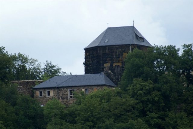
The castle complex is about 60 meters long and up to 26 meters wide. Altenwied Castle is dominated by the 17-meter-high pentagonal keep, which has a base area of 15 × 9.5 meters and now has a roof. Other parts of the castle (such as the shield wall in the north) are still preserved or have been partially rebuilt. Today, only an external viewing of the inhabited castle is possible.

Take Mobile History with you

You are reading this text for free. Premium adds what matters on the road: descriptions read aloud, sites found through your camera, whole regions taken offline.

  • Every description, including the ~17,700 Premium sites
  • Audio guide: have descriptions read to you on location
  • AR finder: see sites through your camera, with distance and bearing
  • Unlimited saved sites

14 days free, then from €2.99 a month. Cancel anytime.

Source: Wikipedia · Licence: CC BY-SA 4.0 · Image: Roland Neubert, Halle (Saale)

This description draws on the facts documented in the linked Wikipedia article; Wikipedia content is licensed under CC BY-SA 4.0. Wording and editing: Mobile History.

Location: 50.6125, 7.4022