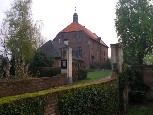
Priest's office
Kervendonk Castle

Kervenheim Castle is mentioned for the first time in a document dated March 4, 1270: Knight Stephan von Wissel and his son Wilhelm transfer their ownership of Kervenheim Castle to Count Dietrich VII of Cleves. How long this castle stood in Kervenheim before its transfer to the Count of Cleves has not been clarified to this day. However, it can be assumed that the castle is much older and is one of the oldest castle complexes on the Lower Rhine. At the beginning of the 14th century, the castle complex was expanded into the "castellum type" as we know it from Jan de Beyer's drawing from the 1740s. The magnificent castle fell victim to a devastating city fire in 1757. A remnant of the buildings was preserved as a manor house. In the 70s of our century, further parts of the manor house were demolished. Since 1898, part of the castle grounds belongs to the Protestant church community, the other part is private property.
So far, no building history investigations of Kervendonk Castle have been carried out. Only the Kleve cadastral map of 1735 shows a floor plan of the castle complex. Since the beginning of 1997, the castle grounds and the "City of Kervenheim" have been under archaeological monument protection. During the laying of natural gas this year, a trench was dug through the entire town center and archaeologically accompanied by the excavation company van de Graaf (Kleve). Insights into the town's development were gained. Castle research could provide further significant facts here.
Take Mobile History with you
You are reading this text for free. Premium adds what matters on the road: descriptions read aloud, sites found through your camera, whole regions taken offline.
- Every description, including the ~17,700 Premium sites
- Audio guide: have descriptions read to you on location
- AR finder: see sites through your camera, with distance and bearing
- Unlimited saved sites
14 days free, then from €2.99 a month. Cancel anytime.
Source: Wikipedia · Licence: CC BY-SA 4.0 · Image: http://www.wehrbauten.de/thread.php?threadid=566&hilight=Borghees
This description draws on the facts documented in the linked Wikipedia article; Wikipedia content is licensed under CC BY-SA 4.0. Wording and editing: Mobile History.
Location: 51.6327, 6.2788