Castle tours available
Town FortificationNamysłów (Namslau)
Namslau Town Fortification
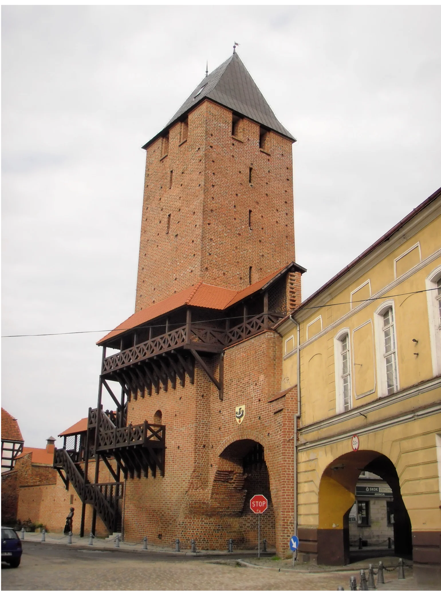
The city fortifications of the Silesian city of Namysłów (German: Namslau) are partially preserved and surround the old town center.
Description and History+
The city of Namslau received its first city fortifications in the 14th century. The foundation stone for the stone wall was laid in 1350 by King Charles IV. The wall was completed in 1359. The 14th-century fortifications originally had two city gates: the Breslau Gate in the west and the Krakow Gate in the east. At the end of the 14th century, the city gates were raised and new towers were erected. Between 1657 and 1659, bastion fortifications were built. Between 1722 and 1724, a final expansion of the city fortifications took place. In the mid-19th century, parts of the city wall were demolished. Between 1856 and 1862, promenades and parks were laid out on the site of the former moats. From 1960 to 1962, the preserved remains of the wall were renovated. Individual fragments of the city wall have been preserved to this day, especially in the southern part of the old town, as well as remnants of four semicircular and ten square defensive towers. The fortifications were entered into the register of monuments of Opole Voivodeship on January 28, 1958, under 262/58.
Krakow Tower+
The Krakow Gate Tower (Polish: Brama Krakowska) on ul. Krakowska was built in the 14th century on a square plan. The six-story tower has a battlements reconstructed in 1960 and a gable roof. The gate has a segmental arch.
Breslau Gate Tower+
The Breslau Gate Tower (Polish: Brama Wrocławska) is a former gate tower. The tower was built in the 14th century on a square plan. In 1863, the gate tower was demolished.
Take Mobile History with you
You are reading this text for free. Premium adds what matters on the road: descriptions read aloud, sites found through your camera, whole regions taken offline.
- Every description, including the ~17,700 Premium sites
- Audio guide: have descriptions read to you on location
- AR finder: see sites through your camera, with distance and bearing
- Unlimited saved sites
14 days free, then from €2.99 a month. Cancel anytime.
Source: Wikipedia · Licence: CC BY-SA 4.0 · Image: Von Autostopowicz - Eigenes Werk, CC BY-SA 3.0 pl, https://commons.wikimedia.org/w/index.php?curid=28156377
This description is a machine translation of an excerpt from the linked Wikipedia article. The source text was written by its authors, the translation is by Mobile History; like the original it is licensed under CC BY-SA 4.0.
Location: 51.0763, 17.7203