CastlePfedelbach-Obergleichen

Gleichen Castle
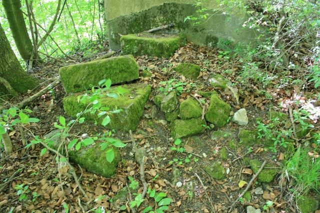
Gleichen Castle

The remains of the castle can be visited

Gleichen Castle is a vanished spur castle on a 467.2 m above sea level high, conical hill on a western spur tip to the right above the Brettach valley, which here runs north-northwest. The castle hill is located about 1.8 km north-northeast of Maienfels Castle, which stands on the left side upstream, in the area of the present-day village of Obergleichen in the Mainhardter Wald, in the municipality of Pfedelbach. Towards the Brettach valley, to the west, the mountain drops steeply. On a high plateau, east and northeast of the castle complex, are the villages of Ober- and Untergleichen, which are overlooked by the castle hill. In common parlance, the hill is called Schlossberg.

To the left, the Schlossberg in Pfedelbach-Obergleichen, next to it on the right the so-called Hinterweiler and in the background on the right the Zollknock

Description+

The 34 × 35 meter leveled castle plateau overlooks the village of Obergleichen by about 15 meters and is surrounded on three sides by an artificial ring wall with a moat. The moat and the wall, which is still up to 2 meters high in parts, are clearly recognizable. No ruins or even remains of masonry are left. Presumably, the castle ruin was used as a quarry by the inhabitants of the adjacent villages after its abandonment, and the masonry was removed over the centuries as cheap building material. However, stone rubble and brick remains indicate that a solid castle structure was formerly present on the castle plateau. A recognizable depression on the site could indicate a foundation, and an existing mound is likely to be a building remnant.

The strategically excellent location of the castle hill and the wide view over the Mainhardter Wald and the Löwensteiner Berge suggest that the castle played an important role at the time of its construction. The castle was probably built as an imperial castle in the course of the Staufer administrative reform in the 12th century. It was the seat of the Gleichen lordship until its decay from 1416. It and its owners and presumed builders, the Lords of Gleichen, were first mentioned in a document in 1294 as "de Gliche". Otherwise, very little is known about this family. After their extinction or departure, the Lords of Limpurg were probably the first owners of the complex. Between 1298 and 1308, Gleichen came into the possession of the Lords of Löwenstein under King Albrecht I. In 1332, another mention of the castle is found in a document from Emperor Ludwig. Thereafter, the castle changed owners several times and finally passed into the possession of the House of Hohenlohe-Bartenstein in 1416, which remained its owner until the decay of the complex.

Until 1994, a high-level tank for Gleichen's drinking water supply stood on the castle grounds.

In Gleichen, Burgstraße and Am Burgrain commemorate the former castle.

Take Mobile History with you

You are reading this text for free. Premium adds what matters on the road: descriptions read aloud, sites found through your camera, whole regions taken offline.

  • Every description, including the ~17,700 Premium sites
  • Audio guide: have descriptions read to you on location
  • AR finder: see sites through your camera, with distance and bearing
  • Unlimited saved sites

14 days free, then from €2.99 a month. Cancel anytime.

Source: Wikipedia · Licence: CC BY-SA 4.0 · Image: https://commons.wikimedia.org/wiki/File:Burgstall_Gleichen_2008-01.JPG

This description draws on the facts documented in the linked Wikipedia article; Wikipedia content is licensed under CC BY-SA 4.0. Wording and editing: Mobile History.

Location: 49.1356, 9.5193