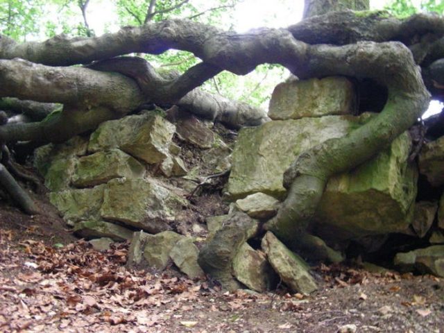
The remains of the castle can be visited
Hünenburg Castle

Hohenrode Castle, also known as Hünenburg, near Hohenrode in the Lower Saxon district of Schaumburg, is a ruin of a medieval hilltop and ringfort in the Lipper Bergland.
Hohenrode Castle is located in the Weserbergland Schaumburg-Hameln Nature Park, 1.4 km (as the crow flies) south-southeast of the village church of Hohenrode, a district of Rinteln. It is situated in the Rumbecker Höhen, which belong to the Lipper Bergland, on the 230.2 m above sea level Hünenburg mountain, a northern spur of the Rumbecker Berg (344.5 m). To the north, the landscape slopes down into the valley of the Weser river, which flows at the foot of the mountain.
As early as around 1130, the Counts of Roden had established a stronghold above the Weser with Roden Castle near the nearby Hessisch Oldendorf. Hohenrode Castle was built by Count Konrad I of Roden around 1170. According to different accounts, Schaumburg troops under Count Adolf III of Schaumburg destroyed the castle in 1180 or 1181, because Konrad I was a supporter of Duke Henry the Lion.
The castle area comprises a site of approximately 55 by 100 m with a large plateau, which is partly bordered by double, deep moats overgrown with bushes and remnants of masonry. Inside the complex are funnel-shaped depressions, indicating former buildings with cellars. There are also traces of a tower and remains of an inner transverse wall.
Excavations took place between 1932 and 1934, revealing various iron artifacts, such as parts of knives and scissors. Among the pottery found, globular pottery could be dated to the 12th century, while earthenware and Siegburg stoneware are attributed to later periods. The ceramic finds confirm that the castle continued to be used after its destruction in 1180 or 1181 until the 14th century. After that, most of the visible above-ground remains of the castle were removed by stone quarrying.
Traffic and Hiking+
The Hohenburg castle ruin can be hiked to, for example, from Hohenrode. At the end of Hünenburgstraße, which branches off to the south from the main road (Landesstraße 433) running through the village, there is a parking lot. From there, a narrow path leads uphill through the forest to the ruin, which can also be reached from Rinteln-Exten via a longer geological educational trail.
Take Mobile History with you
You are reading this text for free. Premium adds what matters on the road: descriptions read aloud, sites found through your camera, whole regions taken offline.
- Every description, including the ~17,700 Premium sites
- Audio guide: have descriptions read to you on location
- AR finder: see sites through your camera, with distance and bearing
- Unlimited saved sites
14 days free, then from €2.99 a month. Cancel anytime.
Location: 52.1614, 9.1577