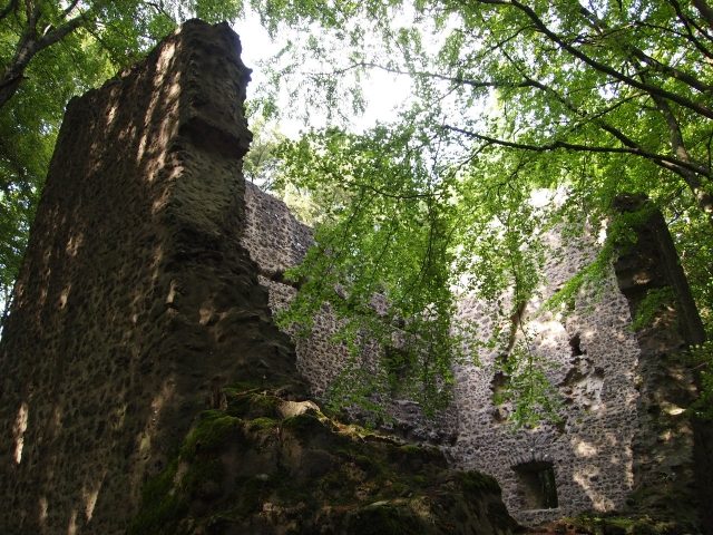
The remains of the Castle can be visited
Freudenkoppe Castle

The Freudenkoppe or Freudenkoppe Castle is the ruin of a hilltop castle, located 1 km southeast of Neroth on the Nerother Kopf in the Vulkaneifel district in Rhineland-Palatinate. The ruin lies on a 610 m above sea level basalt cone, the Nerother Kopf, approx. 5.5 km west of Daun. At the time of the castle's construction, this was the northeastern border of the County of Luxembourg.
Near the castle is the Millstone Cave.
The castle was first mentioned as early as 1337 and completed in 1340 as castrum Froudenkube by John of Luxembourg, King of Bohemia. It served to secure the northeastern border of his dominion, to which Neroth then belonged. After the death of John I the Blind, his son and successor Charles I of Luxembourg, later Emperor Charles IV, ceded the fortified complex in 1346 to the Elector and Archbishop of Trier Baldwin of Luxembourg (1285–1354). It served him as a base during the siege of Daun Castle in 1353. The then stately castle house was built after 1440 under the then castellan and later cathedral provost (under John II of Baden) Philipp von Sierck, brother of Knight Arnold von Sierck (†1444) and uncle of the later Elector and Archbishop of Trier Jakob I von Sierck. The castle was last mentioned in 1460, which suggests that it was abandoned a few years later and fell into disrepair. Exact details about the further history of the castle are not known. It is possible that, if not already dilapidated by then, it was destroyed by the French around 1689. In the 19th century, further wall and building remains are said to have been visible.
Layout+
The almost square residential tower and keep (floor plan of 8.40 m x 8.60 m) in the eastern half of the castle courtyard dominates the castle complex, which is surrounded by a trapezoidal curtain wall, below which on the southern slope are wall remains of the former castle house. To the north, wall remains adjoin. The complex is surrounded on three sides by a dry moat. In the years 1984/85, the preserved ruins were renovated.
Take Mobile History with you
You are reading this text for free. Premium adds what matters on the road: descriptions read aloud, sites found through your camera, whole regions taken offline.
- Every description, including the ~17,700 Premium sites
- Audio guide: have descriptions read to you on location
- AR finder: see sites through your camera, with distance and bearing
- Unlimited saved sites
14 days free, then from €2.99 a month. Cancel anytime.
Source: Wikipedia · Licence: CC BY-SA 4.0 · Image: http://www.wehrbauten.de/thread.php?threadid=2041
This description draws on the facts documented in the linked Wikipedia article; Wikipedia content is licensed under CC BY-SA 4.0. Wording and editing: Mobile History.
Location: 50.1934, 6.7607