CastleDeidesheim

Heidenlöcher Castle

Heidenlöcher Castle

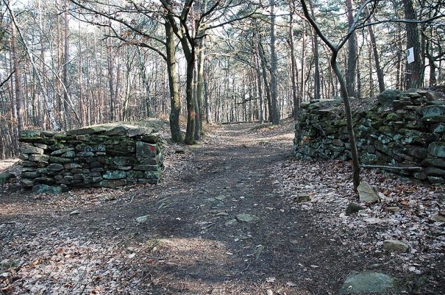
The remains of the Castle can be visited

The Heidenlöcher is the ruin of a hilltop castle near the Palatinate town of Deidesheim in Rhineland-Palatinate. The remains indicate a refuge castle from the Carolingian, possibly also from the Ottonian period.

The Heidenlöcher is a cultural monument according to the Monument Protection Act of the state of Rhineland-Palatinate. Research and targeted collection of finds require permission, and accidental finds must be reported to the monument authorities.

The Heidenlöcher is located about two and a half kilometers northwest of Deidesheim on the summit of the 347-meter-high Martensberg, which belongs to the Haardt, the eastern ridge of the Palatinate Forest. The remains of the refuge castle are surrounded by characteristic Haardt forest, which consists of pure pine forest with typical accompanying flora of heather and blueberries and was formerly used in various ways by the winemakers of the Haardt edge.

On the southeast spur of the Martensberg, called Kirchberg, 500 meters closer to Deidesheim, stands the late Gothic St. Michael's Chapel from 1470. Since its destruction in 1794, it was a ruin and was only rebuilt in 1952.

Presumably, the refuge castle was built in the 9th, or perhaps only in the 10th century, through forced labor, to offer protection to the inhabitants of the surrounding area from the Normans who roamed at that time. A violent destruction cannot be proven; the current ruinous state is due to the decay of the archaeological monuments discovered in the early 19th century.

Research History+

In the 1820s, so-called local history enthusiasts first brought the refuge castle to the attention of a wider public. The excavation was carried out in 1907/08 under the direction of Friedrich Sprater from the Historical Museum of the Palatinate (Speyer). Sprater still assumed that it was a settlement from Celtic times, which is also indicated by the first part of the name.

More recent research has shown that the complex is more than a thousand years younger. The second part of the name comes from the depressions left by the collapsed buildings in the forest floor. According to current knowledge, it is not certain whether the complex was ever used for its intended purpose. It is assumed that the Heidenlöcher were at least never permanently inhabited. Although the building remains indicate extensive internal development, both regularly operated fireplaces and refuse pits are missing.

Complex+

The refuge castle was surrounded by a circular outer wall with a length of about 450 meters, enclosing an oval area of approximately 1.3 hectares; this corresponds to two football fields. The complex extends about 150 meters in an east-west direction and just over 100 meters in a north-south direction.

The ring wall, about two and a half meters high on the outside, was constructed from two parallel components with a total thickness of three meters and consisted of hewn natural stones. It had a lower walkway on the inside and was crowned by a wooden palisade fence, reaching an absolute height of at least three and a half meters. In the north and south, the wall was broken by two gates; the northern one was constructed as a zwinger between two wall sections. An outer fortification consisted of a five-meter-wide ditch, reinforced by a palisade wall.

Inside, there were about 80 to 85 single-story buildings, probably none of which had cellars, and all but one consisted of only a single room, measuring 10 to 20 m². Only one 80 m² building falls outside this pattern; it was probably intended for assembly purposes. All houses show oblique wall alignments and rectangular or nearly square floor plans. The walls were built as dry stone walls from rubble, partly also from large boulders. They likely once supported superstructures of half-timbering or wooden beams.

In addition to a network of narrow alleys, the complex reveals a main path along the inside of the wall, especially on the south front.

Take Mobile History with you

You are reading this text for free. Premium adds what matters on the road: descriptions read aloud, sites found through your camera, whole regions taken offline.

  • Every description, including the ~17,700 Premium sites
  • Audio guide: have descriptions read to you on location
  • AR finder: see sites through your camera, with distance and bearing
  • Unlimited saved sites

14 days free, then from €2.99 a month. Cancel anytime.

Source: Wikipedia · Licence: CC BY-SA 4.0 · Image: http://de.wikipedia.org/wiki/Datei:Heidenloechertor.JPG

This description draws on the facts documented in the linked Wikipedia article; Wikipedia content is licensed under CC BY-SA 4.0. Wording and editing: Mobile History.

Location: 49.4155, 8.1647