CastleRhönblick-Helmershausen

Hutsberg Castle
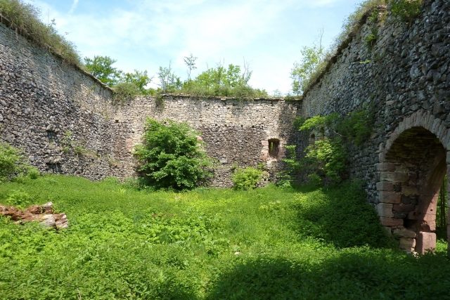
Hutsberg Castle

The remains of the Castle can be visited

The Hutsburg is a high medieval castle complex in the district of Schmalkalden-Meiningen. It is located on the 639 m high Hutsberg, a prominent basalt cone above the right bank of the Herpf near Helmershausen (municipality of Rhönblick) in the Rhön. Due to its proximity to the border, the castle was inaccessible for decades and fell into oblivion.

According to oral tradition, the Hutsberg is said to have had a fortification as early as the 4th century. There are neither written records nor structural remains from this period.

The oldest parts of the Hutsburg probably date from the end of the 12th century, although it was first mentioned in a document in 1273. At this time, the Hutsburg had degenerated into a robber baron's nest and was captured and destroyed around 1275 by Count Berthold von Henneberg-Schleusingen with the support of the cities of Erfurt, Nuremberg, and Würzburg, after King Rudolph had ordered the roads to be kept clear. In 1383, the Counts of Henneberg had the Hutsburg rebuilt as an important strategic stronghold on the southwest flank of their territory and appointed their own burgmannen for its administration. The castle was subsequently pledged several times, and on May 13, 1525, it was finally destroyed by the rebellious peasants in the German Peasants' War.

The complex consisted of a rectangular residential building (palas), a northern corner tower, four shell towers, and a 10 m high and 1.7 m thick curtain wall with an outer moated ditch. The current ruin consists of considerable remains of the curtain wall and the large rectangular residential building from the 14th century. It was freely accessible to visitors, but is currently (2014) closed around the outer walls by a fence erected by the Kaltennordheim Forestry Office.

Take Mobile History with you

You are reading this text for free. Premium adds what matters on the road: descriptions read aloud, sites found through your camera, whole regions taken offline.

  • Every description, including the ~17,700 Premium sites
  • Audio guide: have descriptions read to you on location
  • AR finder: see sites through your camera, with distance and bearing
  • Unlimited saved sites

14 days free, then from €2.99 a month. Cancel anytime.

Source: Wikipedia · Licence: CC BY-SA 4.0 · Image: Joachim Schneeleopard

This description draws on the facts documented in the linked Wikipedia article; Wikipedia content is licensed under CC BY-SA 4.0. Wording and editing: Mobile History.

Location: 50.5502, 10.2434