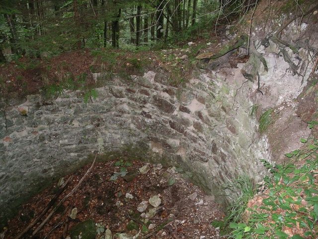
The remains of the castle can be visited
Königstein Castle

The Königstein ruin, also popularly known as Ecker G’schlössl, is a castle ruin in the municipality of Freinberg in Upper Austria, about 5 kilometers from the city of Passau.
The ruin is located on a hillside spur high above the valley of the Kösslbach, the Kößlgraben.
Königstein Castle is one of the few fortifications for which both the date of construction and the time of destruction are known. Its short history begins on Epiphany in 1410, from which, according to legend, the name Königstein is derived. Duke Johann of Holland-Straubing had the castle built in the immediate vicinity of the city of Passau to better control the trade routes into the city, possibly also for protection against the Hussites. Already in 1411, disputes arose between the Bishop of Passau and the Duke, which were settled by a truce agreement on July 20, 1411, in Neuburg. After the death of Duke Johann, Lower Bavaria was divided, and Ludwig the Bearded received the part of the Innviertel bordering the Diocese of Passau. Under the new owner, the fighting flared up again, and Königstein Castle became the starting point for raids into Passau territory. Bishop Leonhard of Passau obtained permission from Emperor Sigismund to demolish the castle. After an initially unsuccessful siege of Schärding, Königstein was captured by a Passau army on July 27, 1436, after a 7-day siege, destroyed, and - as stipulated in the Peace Treaty of Regensburg on July 29, 1436 - never rebuilt.
Layout+
Only a few wall remnants of the ruin remain. The stump of the keep (it was excavated in the 1970s) and a cellar room almost filled to the ceiling with rubble are still clearly recognizable. The core of the round tower consists of granite ashlar, which is externally clad with tuff ashlar. These must have been transported from afar, as there are no tuff deposits in the Sauwald. The wall thickness reaches 2 meters, so the former height of the tower, which has a diameter of 9 meters, can be estimated at 15 meters. Furthermore, the neck ditch and a double rampart-ditch system around the castle are still discernible in the terrain. In the meantime, the castle site has become so overgrown again that hardly any remains of the former castle are visible.
The ruin was excavated on the initiative of the Passau local history enthusiasts; it is now generally accessible. However, since the path is not signposted, it is very difficult to find it. If you have traveled about two kilometers on the road from Freinberg to Hareth, after a small hamlet you will see a forest road turning left downwards. You must follow this for about 1.5 km, and then a poorly visible forest path branches off to the northeast. If you follow this, you will reach the ruin after about 500 m.
Take Mobile History with you
You are reading this text for free. Premium adds what matters on the road: descriptions read aloud, sites found through your camera, whole regions taken offline.
- Every description, including the ~17,700 Premium sites
- Audio guide: have descriptions read to you on location
- AR finder: see sites through your camera, with distance and bearing
- Unlimited saved sites
14 days free, then from €2.99 a month. Cancel anytime.
Source: Wikipedia · Licence: CC BY-SA 4.0 · Image: http://commons.wikimedia.org/wiki/File:K%C3%B6nigstein_Bergfried.JPG
This description draws on the facts documented in the linked Wikipedia article; Wikipedia content is licensed under CC BY-SA 4.0. Wording and editing: Mobile History.
Location: 48.5594, 13.5414