CastleFrauenstein-Kraig

Niederkraig Castle
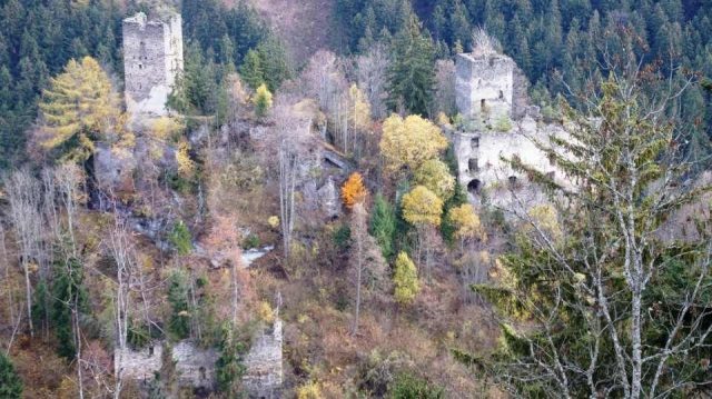
Niederkraig Castle

The remains of the Castle can be visited

Among the most interesting ruins of the castle ring protecting St. Veit are the so-called Kraiger Castles. The ensemble consists of several parts: the main castle Niederkraig, Hochkraig equipped with an outwork, and an aqueduct running between the two ruins.

Niederkraig (also Neukraig) is the younger of the two castles and was probably built in the 13th century. Its largest part was likely constructed in the late 14th century. In 1091, a Dietricus de Kriwig is mentioned for the first time in a document. The Kraiger castles were so defensible that they were never seriously attacked. Only in 1269 did they have to open their gates to the Bohemian King Przemysl Ottokar.

When the family died out in 1564 with Konrad von Kraig, his sister Barbara inherited part of the property. Barbara was married to Johann Graf von Hardegg. Her daughter Elisabeth had married Georg Graf von Nogaroll in her second marriage. Around 1566, he paid off the two remaining heirs, so that after his wife's death, he became the sole owner of the dominion. Archduke Karl sold his rights in 1570 to Georg Khevenhüller von Aichelberg. He then sold the dominion to Ludwig Grotta von Grottenegg.

His descendants no longer lived in Kraig, so the two residences were left to decay. However, a part of Niederkraig was still inhabited until the end of the 18th century. In 1682, Josef Wilhelm Graf von Kronegg acquired the Kraiger dominion. In 1686, it came into the possession of Franz Andreas von Mayerhoffen, with whose family it remained until 1806. Then Josef Bogner, Knight von Steinberg, bought it. Since 1822, the surrounding forests with the two ruins have belonged to the Counts Goess.

Take Mobile History with you

You are reading this text for free. Premium adds what matters on the road: descriptions read aloud, sites found through your camera, whole regions taken offline.

  • Every description, including the ~17,700 Premium sites
  • Audio guide: have descriptions read to you on location
  • AR finder: see sites through your camera, with distance and bearing
  • Unlimited saved sites

14 days free, then from €2.99 a month. Cancel anytime.

Source: Wikipedia · Licence: CC BY-SA 4.0 · Image: http://www.wehrbauten.at/ktn/kaernten.html

This description draws on the facts documented in the linked Wikipedia article; Wikipedia content is licensed under CC BY-SA 4.0. Wording and editing: Mobile History.

Location: 46.7975, 14.3497