The remains of the Castle can be visited
CastleKordel
Ramstein Castle
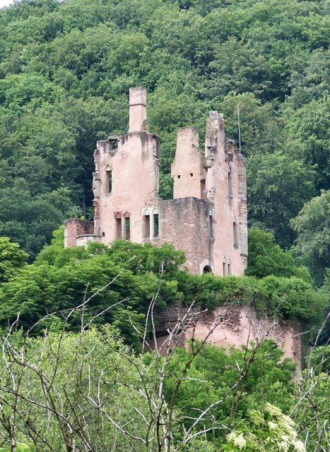
The castle ruin of Ramstein is on a sandstone rock in the lower Kyll valley near Kordel in Rhineland-Palatinate.
History+
The origins of the complex date back to the early 10th century, when Archbishop Radbod of Trier had a fortified manor house built, which he transferred to his vassal Vollmar around 927. This estate, known by names such as Runnesstein or Castrum Ruynstein, served as an agricultural farm. It was not until the beginning of the 14th century that the Trier Archbishop Diether von Nassau began constructing the current Ramstein Castle at this location on an old Roman road. Completion occurred under his successor Balduin von Luxemburg, who enfeoffed the castle to Johann von Bruch in 1310. The castle changed hands several times and was repeatedly repaired, including in 1488 under Choir Bishop Dietrich von Stein. In the 16th century, Archbishop Richard von Greiffenklau zu Vollrads had a water pipeline laid to the castle. During the War of the Palatine Succession, Ramstein Castle was occupied by French troops in 1689, set on fire, and blown up, initiating its final decay. Reconstruction did not take place.
Source: Wikipedia · Licence: CC BY-SA 4.0 · Image: http://commons.wikimedia.org/wiki/File:Burg_Ramstein_Kylltal_cropped.jpg?uselang=de
This description draws on the facts documented in the linked Wikipedia article; Wikipedia content is licensed under CC BY-SA 4.0. Wording and editing: Mobile History.
Location: 49.8238, 6.6441