The remains of the Castle can be visited
CastleÜberackern - Oberrothenbuch
Ratzlburg Castle
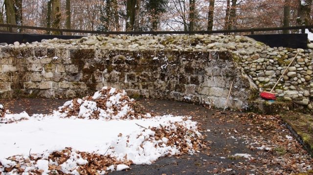
The Ratzlburg is the ruin of a spur castle from the Staufer period on a mountain spur near Oberrothenbuch (Braunau am Inn) and is located in the municipality of Überackern in Upper Austria. The lords of the castle belonged to the Rohr family.
History+
The Ratzlburg was built in the 12th century. As early as 1277, Heinrich von Rohr donated the Ratzlburg to Ranshofen Abbey. From this point on, the complex was abandoned and served the population as a quarry for obtaining building materials; for example, the tower of the nearby parish church of Schwand was built from stones from the Ratzlburg. The residential tower was excavated and preserved by the Upper Austrian State Museums between 1992 and 1998.
Description+
The defining part of the castle is an octagonal residential tower from the Staufer period. It has cavities that accommodated tie beams about 0.3 m wide, and the wall thickness is 2.5 m. The walls are constructed using a two-shell technique. The inner and outer shells consist of tufa, the space in between is filled with layers of large river pebbles in lime mortar.
Source: Wikipedia · Licence: CC BY-SA 4.0 · Image: http://www.wehrbauten.at
This description is a machine translation of an excerpt from the linked Wikipedia article. The source text was written by its authors, the translation is by Mobile History; like the original it is licensed under CC BY-SA 4.0.
Location: 48.2055, 12.9542