CastleRechenberg-Bienenmühle

Rechenberg Castle
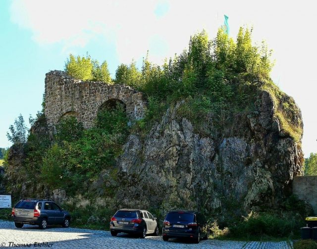
Rechenberg Castle

The remains of the Castle can be visited.

The castle ruin Rechenberg, also called Schanze, Burgruine, Schloss, Burgberg, is the ruin of a hilltop castle on a west-facing mountain spur above the Freiberger Mulde in the east of the municipality Rechenberg-Bienenmühle in the district of Mittelsachsen.

The castle, built on an older fortification consisting of a three-part wooden castle with ramparts and a ditch system, which served to protect a mountain pass, was first mentioned in a document in 1270 with Apitz de Rechenberg. Heinrich von Rechenberg also appears as a witness in this document. The Wettins acquired the entire lordship of Riesenburg from the Hrabischitzers in 1389, and from 1459, Rechenberg definitively remained with Saxony.

The castle was the ancestral seat of the Rechenberg family. In the 14th century and 1571, castle-like alterations took place.

The word part "Rechen" most likely refers to the heraldic symbol of the hay rake of the Hrabischitzers. The word part "berg" (mountain) most likely suggests German (Frankish) settlers.

The area of the medieval fortification Rechenberg was placed under archaeological protection in 1969.

Layout+

The original layout of the castle with its three cores and an extent of approximately 70 by 150 meters can be regarded as one of the largest medieval fortifications in the Ore Mountains. The small stone castle on the westernmost rock probably only originated after the decay of the eastern part of the complex.

The castle complex was separated from the village by a mighty neck ditch and was probably accessible via a drawbridge. From the castle courtyard, one can see the old palas, whose uppermost floor consists of half-timbering and which is the highest building on the castle grounds. Next to it is another elongated house, which leans against one of the two defensive towers. Both buildings now serve as a youth hostel.

Take Mobile History with you

You are reading this text for free. Premium adds what matters on the road: descriptions read aloud, sites found through your camera, whole regions taken offline.

  • Every description, including the ~17,700 Premium sites
  • Audio guide: have descriptions read to you on location
  • AR finder: see sites through your camera, with distance and bearing
  • Unlimited saved sites

14 days free, then from €2.99 a month. Cancel anytime.

Source: Wikipedia · Licence: CC BY-SA 4.0 · Image: Thomas Eichler

This description draws on the facts documented in the linked Wikipedia article; Wikipedia content is licensed under CC BY-SA 4.0. Wording and editing: Mobile History.

Location: 50.7361, 13.5562