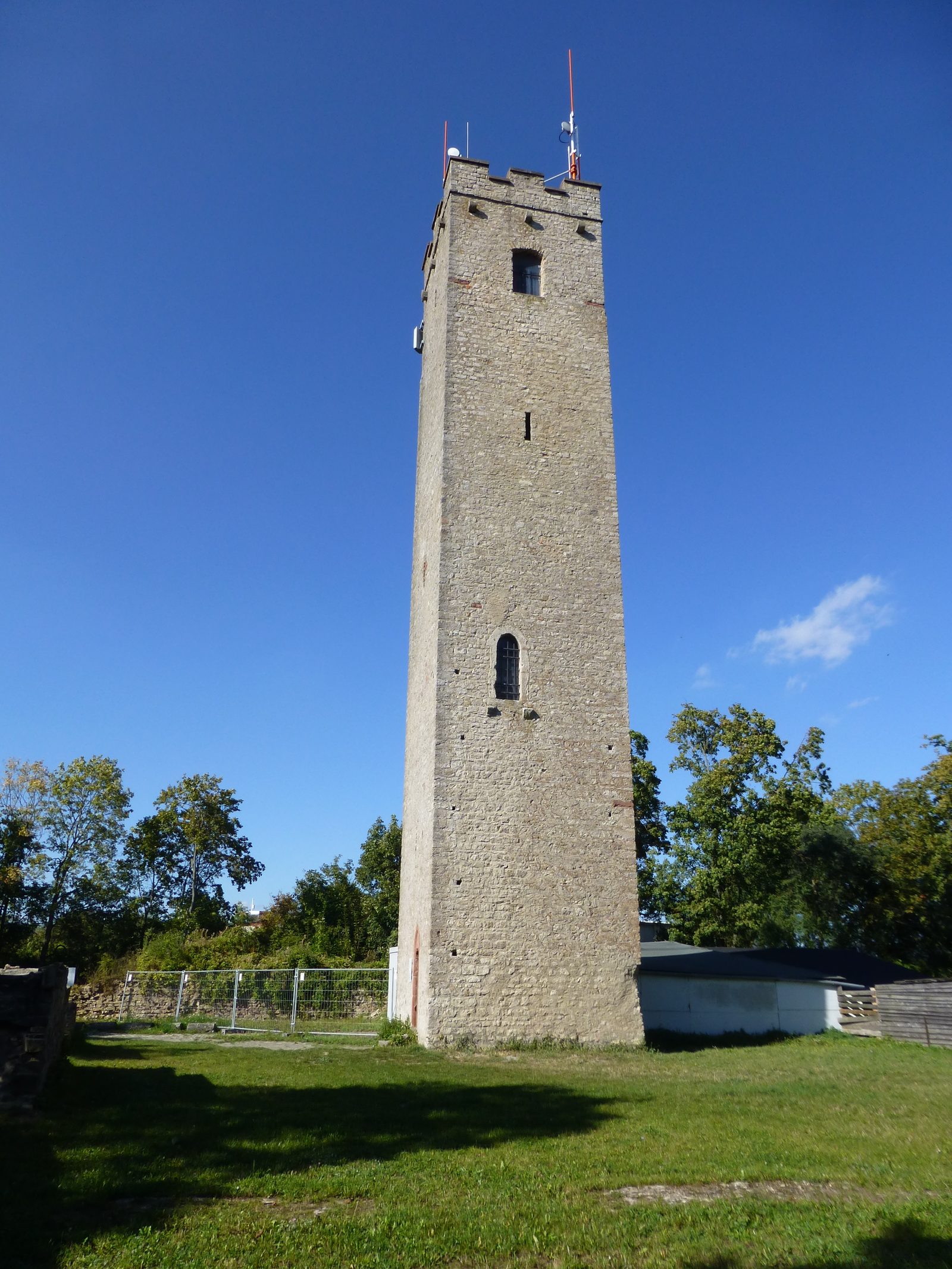
The remains of the Castle can be visited
Rossberg Castle (Schenken Castle)

The former Schenkenschloss Castle is situated high above the Dürrbach Valley near Würzburg. The castle complex is located northwest of the Unterdürrbach district on the Roßberg at 296 m above sea level, on the right side of the Main river.
Schenkenschloss Castle was known as Roßberg Castle until about 1600. The Schenken von Rossenberg were first mentioned in documents around 1270, and the keep dates from this period. The family served the Diocese of Würzburg as cupbearers at court. In 1293, the castle and its associated chapel were first mentioned in documents. In 1445, the castle burned down. In 1448, an expanded reconstruction followed. In the 14th and 15th centuries, the Zwinger (outer bailey) was built. In the Peasants' War of 1525, the citizens of Würzburg's Pleicherviertel plundered and burned the castle. After the suppression of the uprising, Lord of the Castle Georg Schenk twice appealed to them, unsuccessfully demanding atonement and compensation. On August 7, he complained to the mayor and the Würzburg city council, threatening a feud and a lawsuit before the princes. Only Bishop Konrad II von Thüngen compensated him with 1225 guilders, of which he only received 1024 1/4. The sum was insufficient for reconstruction, and the burned-out castle remained a ruin.
Due to Schenk's poverty, the lordship reverted to the Prince-Bishopric of Würzburg in 1537. Old records mention the construction of a farmstead in 1580 and a slight reconstruction around 1600. In 1879, the Schenkenschlossverein (Schenkenschloss Association) was founded for the ruin. This association restored the keep by 1881 and installed an entrance door on the ground floor. In 1959 and 1997, renovations and measures were carried out to preserve the building fabric of the Schenkenturm. Today, the Free State of Bavaria owns the ruin.
Existing Architecture+
The complex today consists of the old keep, as well as a few wall remnants and a moated ditch. The rather narrow keep, 28 m high, is the center of the complex and one of its oldest elements. It was restored in 1881 and received a viewing platform with battlements, which now characterize its appearance. On its exterior, the old round-arched entrance and numerous small loophole-like windows can still be seen. On the uppermost floor, corbels still protrude from the wall, reminiscent of a wooden walkway.
Apart from the keep, not much of the rest of the castle is currently preserved. In the late 14th or early 15th century, a 6-meter-wide Zwinger (outer bailey) was built around the core castle, which had small defensive towers at its four corners. In the northwest, to the left of the current access, there was once a gatehouse with a drawbridge. Remnants of a bridge pier can still be seen in the castle moat. On the castle grounds stands a small piece of wall, which must have been part of the old curtain wall.
Current Use+
The Flugsport-Club Würzburg e.V. (Würzburg Aviation Club) uses the tower for the Schenkenturm airfield as a wind indicator, thanks to the windsock attached to the top of the keep, and as a landmark for visual flight operations.
Future Plans+
The non-profit association "Die Roßperger" has taken on the ruin, with the preservation of Schenkenschloss as its purpose. In addition to securing the existing walls, the Roßperger plan to rebuild the castle's vaulted cellar and use it as a club house and event venue.
Take Mobile History with you
You are reading this text for free. Premium adds what matters on the road: descriptions read aloud, sites found through your camera, whole regions taken offline.
- Every description, including the ~17,700 Premium sites
- Audio guide: have descriptions read to you on location
- AR finder: see sites through your camera, with distance and bearing
- Unlimited saved sites
14 days free, then from €2.99 a month. Cancel anytime.
Source: Wikipedia · Licence: CC BY-SA 4.0 · Image: Reinhold Schulz
This description draws on the facts documented in the linked Wikipedia article; Wikipedia content is licensed under CC BY-SA 4.0. Wording and editing: Mobile History.
Location: 49.8161, 9.8992