The remains of the Castle can be visited
CastleTaufers im Münstertal
Rotund Castle
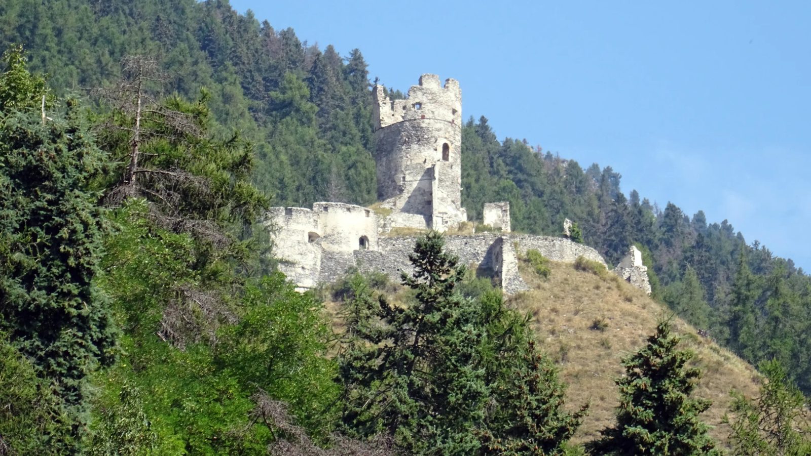
The castle ruin Rotund (also called castle) near Taufers im Münstertal in South Tyrol is located at an altitude of about 1500 m above sea level and is one of the highest castles in Tyrol. The alternative name Oberreichenberg refers to Reichenberg Castle, which is located about 150 meters lower.
Location+
The castle, situated on a steeply sloping hill on three sides, could only be reached from the north side via a 15 to 20 meter deep saddle over a drawbridge. The round keep, still visible today, is located at the highest point of the castle area. It was not until 1957 that the Soprintendenza delle Belle Arti had an iron band placed around the split tower, as it threatened to collapse. The ruin is freely accessible, but there is a risk of collapse.
History+
The complex was built around 900 by the bishops of Chur and initially used by them as a residence. In 1150, they gave the castle as a fief to the nobles of Rotund. The noble family of von Rotunder died out in 1288, and the castle passed to the Barons of Reichenberg. In 1310, the complex was sold to Heinrich von Reichenberg. The Reichenbergers sold the castle in 1381 to the Count of Tyrol, who in turn leased it as a Chur sub-fief to the Barons of Schlandersberg. The brothers Kaspar and Heinrich von Schlandersberg, who were notorious for their assaults, even against their own subordinates, belonged to the noble opposition against the Habsburg Duke Frederick with the Empty Pockets, who conquered Rotund and Reichenberg Castles in 1417. Their castle Hochgalsaun was also destroyed in 1423. In 1448, Ulrich von Schlandersberg exchanged the castle with Duke Sigmund for the castle and city of Bludenz. In the 15th century, the castle was renovated and a corner rondel was added. From 1555, the later Counts of Hendl bought the property and kept it until the 19th century. The last lord of the castle was Baron von Heydorf. Today, Rotund Castle is owned by the municipality of Taufers im Münstertal. In 2011, safeguarding work was carried out by the South Tyrolean Provincial Monuments Office.
Take Mobile History with you
You are reading this text for free. Premium adds what matters on the road: descriptions read aloud, sites found through your camera, whole regions taken offline.
- Every description, including the ~17,700 Premium sites
- Audio guide: have descriptions read to you on location
- AR finder: see sites through your camera, with distance and bearing
- Unlimited saved sites
14 days free, then from €2.99 a month. Cancel anytime.
Source: Wikipedia · Licence: CC BY-SA 4.0 · Image: Foto: Jörg Heldt (Community)
This description is a machine translation of an excerpt from the linked Wikipedia article. The source text was written by its authors, the translation is by Mobile History; like the original it is licensed under CC BY-SA 4.0.
Location: 46.6555, 10.4682