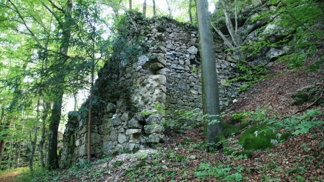
The remains of the castle can be visited
Sarmingstein Castle

In the literature on regional and castle history, Säbnich and Sarmingstein were long considered identical. Only the discovery of another castle complex at the "Burgstall" upstream on the Sarmingbach has sustainably shaken this thesis. Alfred Höllhuber and Leopold Mayböck, in particular, have pointed out the separate ownership and dominion history of these two neighboring complexes.
Accordingly, an early existence of Sarmingstein under the Hochfreie von Machland and under the Babenbergs as successors in possession is not documented by sources. Only under the Sommerauers is the castle traceable in the second half of the 13th century. In 1296, it was among the castles destroyed during the noble uprising against Albrecht I.
After that, the castle and dominion only reappeared in the late 15th century; around 1470, the castle, which was in princely possession, was administered by the Lords of Prüschenk. In 1488, Emperor Friedrich III commissioned Siegmund and Heinrich von Prüeschenk to rebuild Sarmingstein Castle. The fact that the Lords of Prüeschenk used the castle as their residence during the construction of Greinburg from 1491 speaks for a rapid construction. With the completion of Greinburg in 1493, the center of power of the Prüeschenk must have been moved to Grein. In 1513, Emperor Maximilian handed Sarmingstein over to Waldhausen Abbey. Under Provost Konrad von Waldhausen, the castle's tower and bastions were repaired in 1534 on behalf of Emperor Ferdinand I, which could refer to the core castle, the massive field-side outwork, and the tower in the village area. In 1645, the castle was destroyed by the Swedes and has remained a ruin ever since.
The overall complex of Sarmingstein Castle includes the Danube-side outwork dating from the 15th century. This is located directly below the castle rock. The tower was part of a bastion that presumably extended from Sarmingstein Castle to the Danube. The difficult-to-access remains of the castle are located further north in the Painwald high above Sarmingstein.
Take Mobile History with you
You are reading this text for free. Premium adds what matters on the road: descriptions read aloud, sites found through your camera, whole regions taken offline.
- Every description, including the ~17,700 Premium sites
- Audio guide: have descriptions read to you on location
- AR finder: see sites through your camera, with distance and bearing
- Unlimited saved sites
14 days free, then from €2.99 a month. Cancel anytime.
Source: Wikipedia · Licence: CC BY-SA 4.0 · Image: http://www.wehrbauten.at
This description draws on the facts documented in the linked Wikipedia article; Wikipedia content is licensed under CC BY-SA 4.0. Wording and editing: Mobile History.
Location: 48.2343, 14.9416