The remains of the Castle can be visited
CastleBacharach-Steeg
Stahlberg Castle
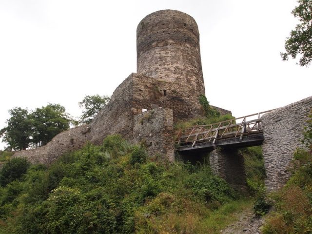
The Stahlberg castle ruin, a spur castle, is an integral part of the UNESCO World Heritage Upper Middle Rhine Valley.
History+
Dendrochronological investigations from 2005 date the construction of the entire complex to the period between 1158 and 1168. This refuted earlier assumptions about different construction times for the upper and lower castles. A second expansion phase took place in the second quarter of the 14th century, which became necessary to repair damage to the rectangular keep and the southwestern curtain wall. During this time, the round keep was also raised. Further construction measures are documented around 1470. The castle was probably originally built on behalf of the Archbishops of Cologne to secure their landholdings in the region. As early as 1243, the castle, along with Fürstenberg, was granted as a fief to the Wittelsbach Palatine Counts. With the exception of a period of pledging to the Archbishops of Trier from 1317 to 1353, it remained in the possession of the Palatine Counts and was administered for a long time by the Burgraves Knebel von Katzenelnbogen. During the Thirty Years' War, the castle was damaged by Swedish troops in 1631 and was finally destroyed by French armies in the War of the Palatine Succession in 1689.
Source: Wikipedia · Licence: CC BY-SA 4.0 · Image: http://www.wehrbauten.de/thread.php?threadid=899&sid=246e8c9fdbfa80ccf9a3497b2adfd6ed
This description draws on the facts documented in the linked Wikipedia article; Wikipedia content is licensed under CC BY-SA 4.0. Wording and editing: Mobile History.
Location: 50.0570, 7.7386