The remains of the fortress can be visited
Ancient BuildingNieul-sur-l'Autise
Champ-Durand
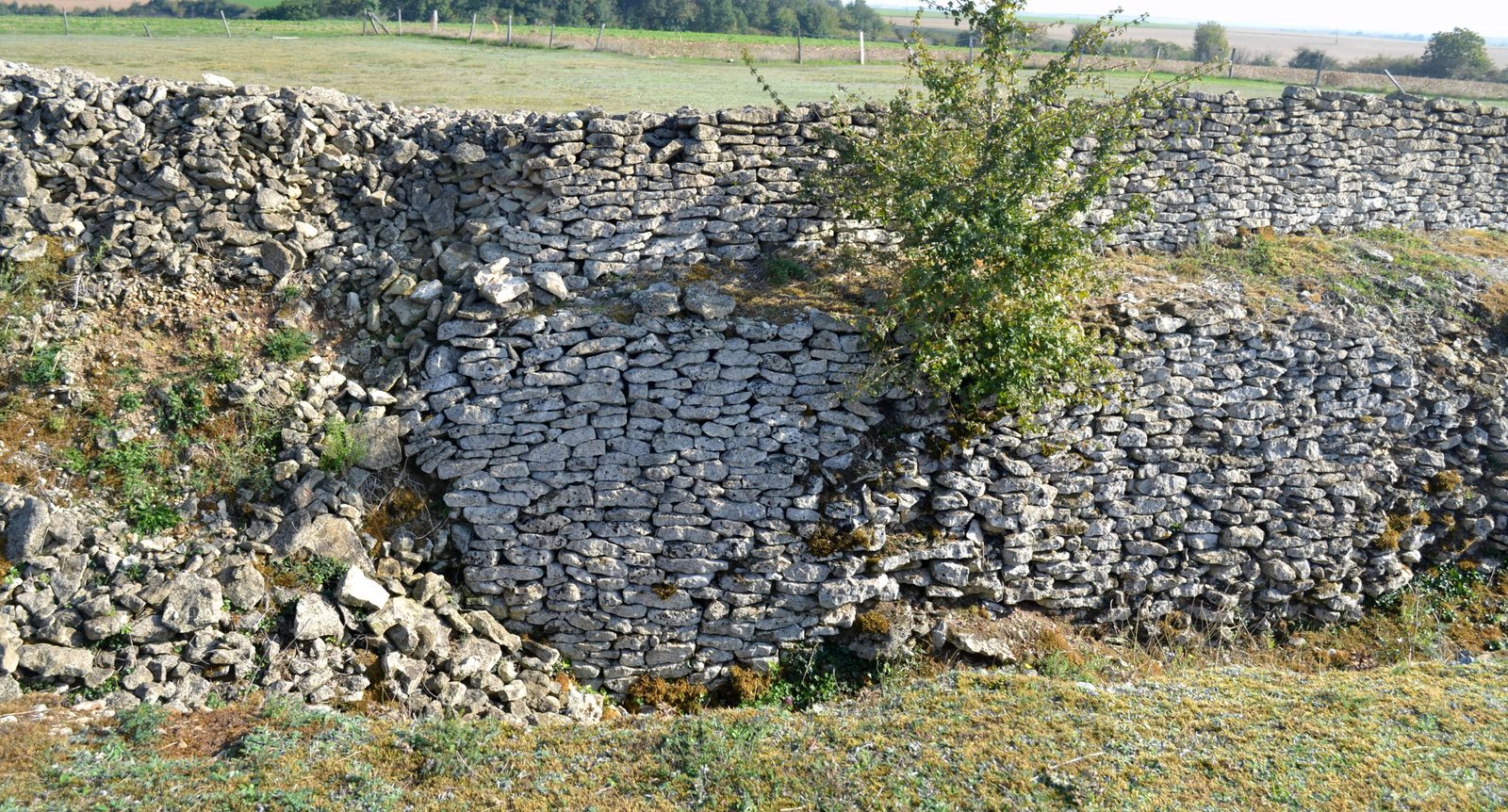
The prehistoric enclosure of Champ-Durand is an interrupted ditch system (French: enceinte à fossé interrompu) southeast of Nieul-sur-l’Autise in the far southeast of the Département Vendée in France. The enclosure (French: enceinte) originated in the Neolithic period and was used until the early Bronze Age. It has been a Monument historique since 1990.
History+
The enclosure was discovered in 1971 by Maurice Marsac (1938–1991) on satellite photos and excavated between 1975 and 1985 by Roger Joussaume.
Description+
The triple enclosure, which defines an almost circular area with a diameter of about 250 m and slightly less than 2.0 ha in size, forms three sides of the settlement site. The fourth side to the south is delimited by the dry valley of Les Maléons. The enclosure consists of three ditch systems at a distance of 15 to 20 m. Each ditch consists of several depressions separated by a dozen interruptions. The interruptions may have been blocked by walls, others were entrances. The examination of satellite photos in 2010 made it possible to discover one of these interruptions, called "pince de crabe" ("crab claw") in French. The 1.5 km long ditches were dug with deer antler shovels, several of which were found in ditch No. 1. The three ditches may not have been excavated simultaneously. The ditches decrease in width and depth towards the outside. The inner ditch, 5.0 to 7.0 m wide, was dug 2.3 m to 2.6 m deep into the limestone subsoil. The middle ditch is on average 4.0 m wide and about 2.0 m deep. The outer ditch is 3.0 m wide and 1.8 m deep. The current form of the ditches does not correspond to the original, as changes led to a backfilling of the base. The inner wall of the ditches was reinforced by walls consisting of stone blocks quarried during the excavation of the ditches. These walls extend above the ditches to a height of 2.50 m to 3.0 m. Over time, several modifications were made to the enclosure, serving various functional purposes. In the early Bronze Age, palisades were erected in the northern part.
Finds+
Apart from some scattered bones, human bones with fatal skull injuries were found in five areas at the bottom of the second ditch. This small number of burials and the trauma suffered could have special significance – comparable to the discoveries made in nearby Châtelliers-de-Vieil-Auzay. Finds in the ditches also include polished axes, some of which came from the dolerite quarry of Plussulien, pierced arrowheads (with fins and tang) and flint daggers, truncated cone-shaped vases, ceramics typical of the Bell Beaker culture, including a small decorated vase of the Gobelet type, and many grinding stones. Furthermore, bone and antler tools as well as clay loom weights appeared. The pottery characteristic of Champ-Durand also appears in various megalithic structures in the south of the Vendée (Tumulus du Pey de Fontaine) and in northern Maine-et-Loire.
Cultural Affiliation+
The use of the site is attributed to the Peu-Richard culture (3400 to 2900 BC). The bearers of the culture used fortified camps of more than 150 m in diameter, surrounded by deep ditches, as also found in Barzan, Semussac, L’Éguille and Cozes (all in the adjacent Département Charente-Maritime). The Champ-Durand site was also briefly reused in the late Neolithic, but by then the walls had already collapsed. In the early Bronze Age, the ditches were completely filled.
Take Mobile History with you
You are reading this text for free. Premium adds what matters on the road: descriptions read aloud, sites found through your camera, whole regions taken offline.
- Every description, including the ~17,700 Premium sites
- Audio guide: have descriptions read to you on location
- AR finder: see sites through your camera, with distance and bearing
- Unlimited saved sites
14 days free, then from €2.99 a month. Cancel anytime.
Source: Wikipedia · Licence: CC BY-SA 4.0 · Image: Liberliger · Wikimedia Commons · CC BY-SA 4.0
This description draws on the facts documented in the linked Wikipedia article; Wikipedia content is licensed under CC BY-SA 4.0. Wording and editing: Mobile History.
Location: 46.4147, -0.6592