The remains of the Castle can be visited
CastleVienne
Château de la Bâtie
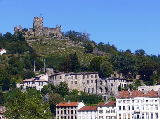
The Château de la Bâtie is a former fortified castle or "bâtie" from the 13th century whose ruins stand in the commune of Vienne sur le Rhône in the Auvergne Rhône-Alpes region. The castle was listed as a historical monument by decree on December 10, 1926.
Location+
The Château de la Bâtie is located in the French department of Isère in the commune of Vienne sur le Rhône.
History+
The enclosure of Vienne spans the five hills on the left bank of the Rhône, including Mont Salomon, for approximately 7 kilometers. To the north and south, it reaches the Rhône but does not include, and therefore does not protect, the southern district, nor those on the right bank. The width of the enclosure was 2.5 m to 4 m and the height at least 8 m, pierced by six gates and punctuated by numerous towers (fifty-eight) located in the valleys controlling access roads. This rampart covers urbanized territories and others that were not, for an area of 200 hectares. According to archaeological data, the Romans had already fortified Mont-Salomon, and the remains of the Roman fort would have been reused during the High Middle Ages. But it was Archbishop Jean de Bernin who is considered the patron for the construction of la Bâtie, around 1225.
Source: Wikipedia · Licence: CC BY-SA 4.0 · Image: http://en.wikipedia.org/wiki/File:Ch%C3%A2teau_de_La_B%C3%A2tie.jpg
This description draws on the facts documented in the linked Wikipedia article; Wikipedia content is licensed under CC BY-SA 4.0. Wording and editing: Mobile History.
Location: 45.5307, 4.8764