The remains of the Castle can be visited
CastleOnhaye
Château de Montaigle
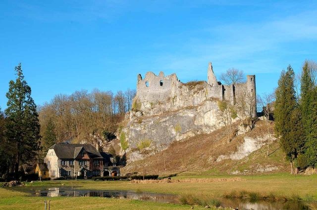
The Château de Montaigle is a ruin in the Walloon province of Namur in Belgium. Situated on a rocky outcrop where the Flavion flows into the Molignée, this spur castle.
History+
As early as the late Roman period, between the 3rd and 5th centuries, a military installation was located on this site. The actual Montaigle Castle was built at the beginning of the 14th century on the foundations of an older structure belonging to the Dampierre family. It was owned by the Counts of Namur, descendants of Guy de Namur, the youngest son of Guy de Dampierre and former regent of Flanders. In the 15th century, the castle underwent expansion into a residential castle with multiple floors, large windows, fireplaces, and cellars. The visible remains today largely date from this period.
Source: Wikipedia · Licence: CC BY-SA 4.0
This description draws on the facts documented in the linked Wikipedia article; Wikipedia content is licensed under CC BY-SA 4.0. Wording and editing: Mobile History.
Location: 50.2932, 4.8154