The Fortress can be visited
FortressHiers-Brouage
Citadelle de Brouage
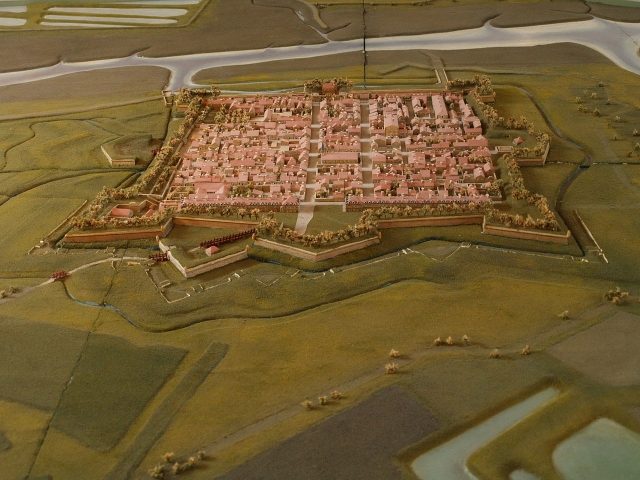
In Hiers-Brouage, in the Poitou-Charentes region of France, lies the Citadelle de Brouage, a fortress situated at approximately 7 meters above sea level.
History+
The origins of the settlement date back to the 11th century, when the village of Hiers emerged on an island in the Gulf of Saintonge. In the mid-16th century, Jacques de Pons founded Brouage as a trading port for salt, which was produced there in large quantities. The port quickly developed into one of Europe's largest and became a center for international salt and cod trade. During the Wars of Religion, Brouage changed hands several times between Catholics and Huguenots. In 1626, the town was integrated into the Kingdom of France and came under the authority of Cardinal Richelieu. Between 1630 and 1640, under Pierre de Conty, it was expanded into the strongest fortress on the Atlantic coast. The 17th century saw Brouage flourish, also due to its connection with the French colonies in Canada, particularly through Samuel de Champlain, born here and founder of Québec. With the receding of the sea and the rise of neighboring Rochefort, Brouage declined in importance during the 18th century and fell into disrepair. Extensive renovation work began only in 1980 to preserve the citadel as a tourist destination.
On site+
The Citadelle de Brouage is now accessible to visitors. It serves as a European center for military architecture and hosts exhibitions that highlight its history and connection to Canada.
Take Mobile History with you
You are reading this text for free. Premium adds what matters on the road: descriptions read aloud, sites found through your camera, whole regions taken offline.
- Every description, including the ~17,700 Premium sites
- Audio guide: have descriptions read to you on location
- AR finder: see sites through your camera, with distance and bearing
- Unlimited saved sites
14 days free, then from €2.99 a month. Cancel anytime.
Source: Wikipedia · Licence: CC BY-SA 4.0 · Image: http://commons.wikimedia.org/wiki/File:Citadelle_de_Brouage_Plan-relief.jpg?uselang=de
This description draws on the facts documented in the linked Wikipedia article; Wikipedia content is licensed under CC BY-SA 4.0. Wording and editing: Mobile History.
Location: 45.8666, -1.0703