To be privately owned
FortressNordenham
Langlütjen I Fortress
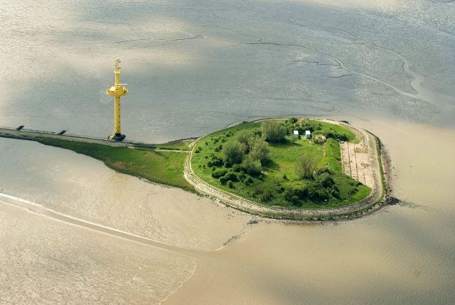
Fort Langlütjen I, a historic structure on an artificial island in the Weser estuary, was originally conceived as a Prussian and later imperial naval fort, serving to protect the ports of Bremen and Bremerhaven.
History+
The island of Langlütjen I was created between 1869 and 1870 on a former sand dune. It was developed into a fortified coastal fort with earthworks, its design influenced by Belgian fortresses and 17th-century French island forts. Its construction was technically challenging, as the site was exposed to the forces of the sea. Approximately 300 workers were employed simultaneously, and building materials were delivered by ship and, from 1870, via a causeway with a narrow-gauge railway. Upon completion, the fort was equipped with nine 21-cm guns in armored turrets and was used militarily until the end of World War I, though it was never involved in combat. After the war, it was demilitarized, and its armaments were removed. During World War II, anti-aircraft positions with 10.5-cm guns were installed. After 1945, the installations were blown up, and the debris was covered with sand in the 1970s for coastal protection. Today, remnants of the ruins still protrude from the sand.
Source: Wikipedia · Licence: CC BY-SA 4.0 · Image: https://en.wikipedia.org/wiki/File:Langl%C3%BCtjen_I_%28Insel%29_2012-05-13-DSCF8515.jpg
This description draws on the facts documented in the linked Wikipedia article; Wikipedia content is licensed under CC BY-SA 4.0. Wording and editing: Mobile History.
Location: 53.5579, 8.5169