The remains of the Castle can be visited
FortressEin Qiniyye (عين قنية; עֵין קֻנִיֶּה)
Nimrod Fortress (Qala'at al-Subeiba, מבצר נמרוד)
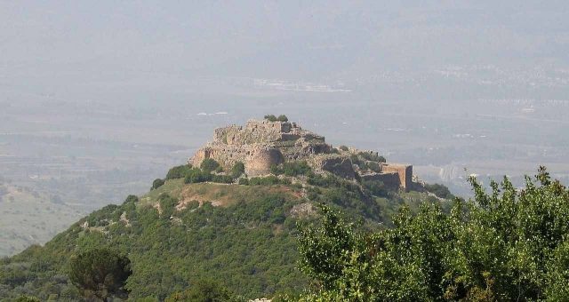
In Ein Qiniyye, in the Central District of Israel, Nimrod Fortress, also known as Qala'at al-Subeiba, is situated. The medieval complex is on a rocky ridge in the Golan Heights and offers insight into 13th-century military architecture.
History+
The origins of Nimrod Fortress date back to the 13th century. It was likely built around 1229 under the aegis of the Ayyubid emir al-Aziz Uthman. Its primary purpose was to protect against potential attacks by the Fifth Crusade on Damascus. In the following decades, the complex underwent extensive expansions under Sultan Baibars I (1260–1277). The fortress played a strategically important role in monitoring trade routes between Galilee and Damascus and served to protect the nearby city of Banyas. It lost significance as the influence of the Crusaders waned. After the Ottoman conquest in 1517, it was briefly used as a prison for the Ottoman nobility before being abandoned in the 16th century and largely destroyed by an earthquake in the 18th century.
Location+
Nimrod Fortress is located at an elevation of approximately 757 m above sea level.
On site+
Today, Nimrod Fortress is a ruin accessible to visitors. The excavated and partially restored areas of the complex invite exploration of the site's history.
Take Mobile History with you
You are reading this text for free. Premium adds what matters on the road: descriptions read aloud, sites found through your camera, whole regions taken offline.
- Every description, including the ~17,700 Premium sites
- Audio guide: have descriptions read to you on location
- AR finder: see sites through your camera, with distance and bearing
- Unlimited saved sites
14 days free, then from €2.99 a month. Cancel anytime.
Source: Wikipedia · Licence: CC BY-SA 4.0 · Image: http://de.wikipedia.org/wiki/Datei:Nimrod-S-218.jpg
This description draws on the facts documented in the linked Wikipedia article; Wikipedia content is licensed under CC BY-SA 4.0. Wording and editing: Mobile History.
Location: 33.2524, 35.7146