The remains of the Castle can be visited
FortressBlagaj
Stjepan grad Fortress
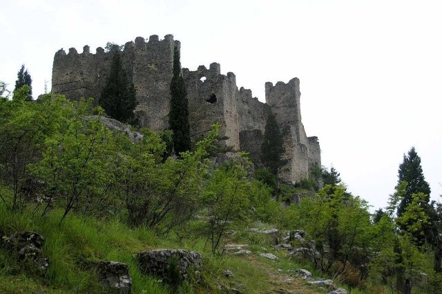
The Stjepan grad Fortress is in Blagaj in the Federation of Bosnia and Herzegovina. This complex offers a ruined landscape.
History+
The history of the fortress begins between the 3rd and 2nd centuries BC with a fortified settlement of the Illyrian tribe Daorsi. Later, the Romans transformed it into a military camp. In the 10th century, the castle, built on Roman foundations, developed into the center of the Hum region. In the 11th century, it was under the control of the princes of Zeta, followed by the Serbian prince Stefan Nemanja. Later it belonged to the Bosnian kings and from 1428 to the noble Kosača family. Duke Stjepan Vukčić Kosača, whose first name gave the fortress its current name, was the last owner before the Ottoman conquest in 1465. The Ottomans expanded the complex with towers, redoubts, a dungeon, and a mosque. An earthquake in 1827 severely damaged the fortress, after which it was abandoned in 1835.
Location+
The Stjepan grad Fortress is situated at an elevation of approximately 290 m above sea level.
Take Mobile History with you
You are reading this text for free. Premium adds what matters on the road: descriptions read aloud, sites found through your camera, whole regions taken offline.
- Every description, including the ~17,700 Premium sites
- Audio guide: have descriptions read to you on location
- AR finder: see sites through your camera, with distance and bearing
- Unlimited saved sites
14 days free, then from €2.99 a month. Cancel anytime.
Source: Wikipedia · Licence: CC BY-SA 4.0 · Image: http://de.wikipedia.org/wiki/Datei:Old_Blagaj_fort.jpg
This description draws on the facts documented in the linked Wikipedia article; Wikipedia content is licensed under CC BY-SA 4.0. Wording and editing: Mobile History.
Location: 43.2599, 17.9027