The Fortress can be visited
FortressPlougonvelin
Fort de Bertheaume
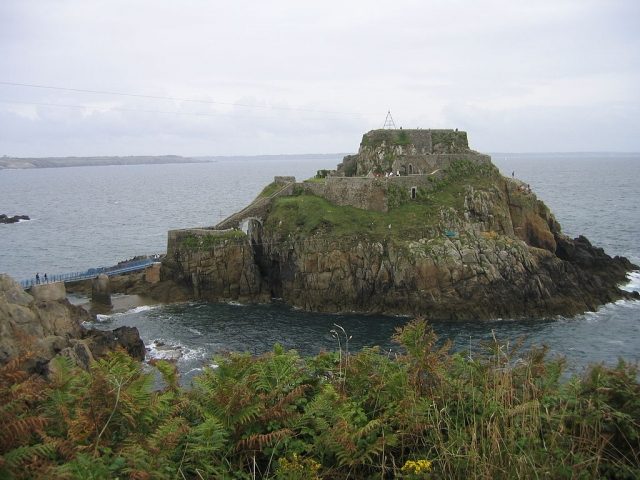
On a small island off the coast of Brittany, France, is Fort de Bertheaume, a fortress that once served to defend the Strait of Brest and is now an accessible historical monument.
History+
The military use of the site began even before the current structure; a predecessor was first mentioned in 1474 and was likely destroyed in 1558. In the late 17th century, specifically 1694, Vauban had a gun battery built here to protect the Bay of Brest, which had been developed into a military port under Cardinal Richelieu. This position played an important role in the Battle of Camaret. The current structure, including a powder magazine located 13 meters underground, dates from the mid-18th century. A bridge, built in 1835, improved accessibility, as the fortress was previously only reachable by boat. In the 1880s, bunker facilities were added. During World War II, the fort was used by German units as part of the Atlantic Wall and offered resistance during the Battle of Brittany. After the war, the island reverted to the French Ministry of Defense but lost its military function. In 1990, the municipality of Plougonvelin acquired the site, after which archaeological research uncovered the fort's history and prepared it for visitors. The pedestrian bridge had to be rebuilt multiple times due to storm damage. On the mainland, there is now an open-air stage, a climbing garden, a menhir ensemble installed in the 1990s, and barbecue areas.
Location+
Fort de Bertheaume is situated in Plougonvelin, in the Finistère department of the Brittany region, France, at an elevation of approximately 2 meters above sea level.
On site+
The island is accessible via a pedestrian bridge, which has been rebuilt multiple times after being destroyed by storms. On the mainland, an open-air stage, a climbing garden, a menhir ensemble, and barbecue areas complement the offerings.
Take Mobile History with you
You are reading this text for free. Premium adds what matters on the road: descriptions read aloud, sites found through your camera, whole regions taken offline.
- Every description, including the ~17,700 Premium sites
- Audio guide: have descriptions read to you on location
- AR finder: see sites through your camera, with distance and bearing
- Unlimited saved sites
14 days free, then from €2.99 a month. Cancel anytime.
Source: Wikipedia · Licence: CC BY-SA 4.0 · Image: http://commons.wikimedia.org/wiki/File:Fort_de_Berthaume_6.JPG?uselang=de
This description draws on the facts documented in the linked Wikipedia article; Wikipedia content is licensed under CC BY-SA 4.0. Wording and editing: Mobile History.
Location: 48.3370, -4.6974