The Fort can be visited
FortressBerlin-Spandau
Fort Hahneberg
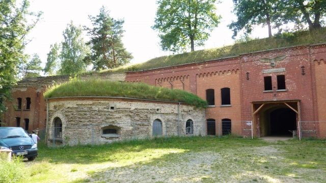
Located on the westernmost edge of Berlin, Fort Hahneberg, completed in 1888 after six years of construction, is considered the last new fortress built in Germany. To protect the armaments center of Spandau, a fortress belt of four forts was planned around the city after the Franco-Prussian War of 1870/71, but only one was realized, as the development of artillery shells, especially the introduction of the high-explosive shell, had by then rendered this type of fortification ineffective.
Due to the excavation of the Hahneberg (66 m above sea level) and the sinking of the fort, the hexagonal "detached work" with an area of 450 m × 170 m is barely visible from the outside.
After its commissioning, the fort was primarily used for military purposes until 1945, including as a barracks and central archive for military medicine. During the Buchrucker Putsch on October 1, 1923, the fort, along with the Spandau Citadel, was briefly occupied by putschists, who soon had to surrender to regular Reichswehr units.
Source: Wikipedia · Licence: CC BY-SA 4.0 · Image: Joachim Schneeleopard
This description draws on the facts documented in the linked Wikipedia article; Wikipedia content is licensed under CC BY-SA 4.0. Wording and editing: Mobile History.
Location: 52.5219, 13.1383