Cemetery entrance
MonasteryRüthen
Kapuzinerkloster Rüthen
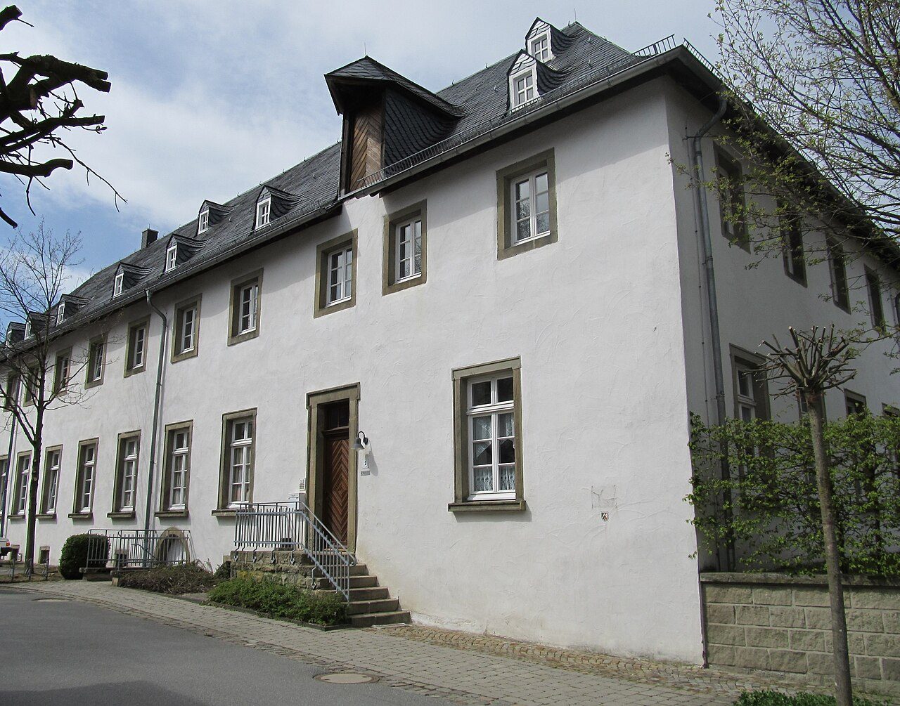
The former Capuchin Monastery of Rüthen, once situated in the Duchy of Westphalia, represents a piece of Baroque monastic architecture and cloistered life. Although the building no longer exists in its original form, preserved elements bear witness to its historical significance as a religious center in the Soest region.
History+
The Capuchins received permission to settle in Rüthen in 1651, leading to the official founding of the monastery in 1654 under the name St. Catharina and St. Elisabeth. The monastery church, a Baroque structure made of Rüthen sandstone, was built around 1683 by Ambrosius von Oelde. It was designed as a single-nave hall church, typical for Capuchin churches, with a recessed choir and a sacristy. The interior included numerous benches and confessionals. The church also served as a burial site for the fathers and lay brothers of the convent, as well as for other servants. The monastery itself was three-winged, arranged around a cloister. The construction was significantly supported by Johann Adolf von Fürstenberg. The monastery possessed a library. In the course of secularization, the monastery was dissolved in 1804, with Minorites from Brilon residing there until 1808. The church was demolished around 1834; only the original portal remained and now serves as the entrance to the municipal cemetery. The rest of the monastery complex was later used as a district court, among other things.
Location+
The Capuchin Monastery of Rüthen was located in the town of Rüthen in the present-day Soest district, North Rhine-Westphalia, Germany. The monastery's location was at an altitude of approximately 375 meters above sea level.
On site+
Of the original monastery complex, only the portal of the former monastery church remains today, serving as the entrance to the municipal cemetery. The other buildings of the monastery were repurposed and partially altered after secularization.
Nearby+
- Rüthen-Hachtor Town Fortification (town fortification, approx. 320 m away)
- Rüthen-Hexenturm Town Fortification (town fortification, approx. 434 m away)
- Körtlinghausen Castle (castle, approx. 3564 m away)
- Welschenbeck House (castle, approx. 7516 m away)
Take Mobile History with you
You are reading this text for free. Premium adds what matters on the road: descriptions read aloud, sites found through your camera, whole regions taken offline.
- Every description, including the ~17,700 Premium sites
- Audio guide: have descriptions read to you on location
- AR finder: see sites through your camera, with distance and bearing
- Unlimited saved sites
14 days free, then from €2.99 a month. Cancel anytime.
Location: 51.4908, 8.4313