To be privately owned
CastleRurka (Rörchen)
Kommende Rörchen
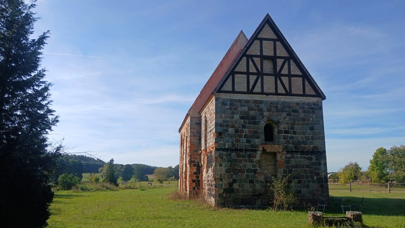
Rörchen commandery was a Templar settlement on the Rörchen brook (Rurzyca), about 4 km north-east of Königsberg in the Neumark (today Chojna). Duke Barnim I of Pomerania-Stettin donated the Land of Bahn to the order in 1234; in 1235 the bishop of Lebus added 200 hides. The Templars built a court and chapel here; the place is named in 1244, and in 1248 Bishop Wilhelm of Cammin probably consecrated the chapel. The first known commander is Friedrich von Salzwedel in 1261. The border location with Brandenburg led to conflicts; in 1290 a Pomeranian duke raided the court. Other commanders included Bernhard von Eberstein and Jordan von Esbecke.
After the suppression of the Templars in 1312, Duke Otto I transferred the estates to the Hospitallers already in 1311. The Hospitallers maintained the commandery (commanders included Henning von Buch in 1334 and Wilhelm von Holsten around 1373). In a feud around 1373/1377 the von Wedel and citizens of Königsberg destroyed the buildings; the chapel survived. General preceptor Bernd von der Schulenburg moved the seat to Wildenbruch in 1382; Rörchen became a mere order farm. After 1648 the order lost the Wildenbruch commandery; the barony went to Sweden, in 1680 to Schwedt-Vierraden, and in 1788/89 to Prussia. In 1816 the Rörchen estate was sold in hereditary lease (owners included Georg Ludwig Hartig, later von Klitzing, and from 1920 to 1945 Modrow). In 1945 it was confiscated and thereafter used as a Polish state farm; today it is in private ownership.
What remains is the fieldstone chapel, single-nave with rectangular chancel (overall about 16.5 × 8.8 m), oriented, of the early Templar chapel type. It later served as a granary and in the nineteenth century as a distillery. Excavations in 1996–2004 confirmed an unfortified monastic-agricultural court with a mill. The chapel is a listed monument in private ownership and is under renovation; the surrounding area has been largely altered.
Take Mobile History with you
You are reading this text for free. Premium adds what matters on the road: descriptions read aloud, sites found through your camera, whole regions taken offline.
- Every description, including the ~17,700 Premium sites
- Audio guide: have descriptions read to you on location
- AR finder: see sites through your camera, with distance and bearing
- Unlimited saved sites
14 days free, then from €2.99 a month. Cancel anytime.
Source: Wikipedia · Licence: CC BY-SA 4.0 · Image: Foto: Jörg Heldt (Community)
This description draws on the facts documented in the linked Wikipedia article; Wikipedia content is licensed under CC BY-SA 4.0. Wording and editing: Mobile History.
Location: 52.9961, 14.4827