The remains of the Castle can be visited
CastleJonesborough
Moyry Castle
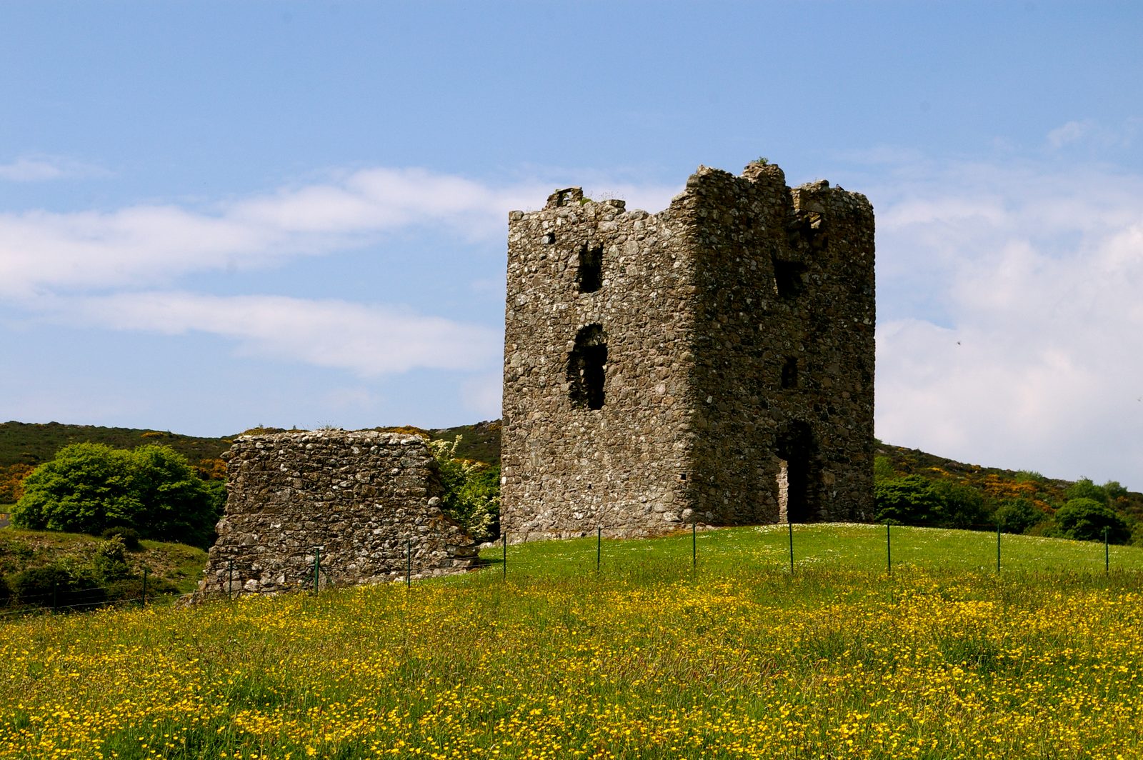
Moyry Castle (from the Irish Maġ Rí or "plain of the king") is a small 17th century castle in County Armagh, Northern Ireland. It was built during the latter stages of the Nine Years' War in June 1601 by Lord Mountjoy to help secure Moyry Pass and the Gap of the North. It is set in the corner of a small bawn and is a rectangular tower three storeys high. Moyry Castle is a State Care Historic Monument sited in the townland of Carrickbroad, in Newry, Mourne and Down District Council area, at grid ref: J0576 1466. The castle is 7.5 miles (12 km) south of Newry town centre, and 5 miles (8 km) north of Dundalk town centre. Moyry Castle, is built on solid rock, It is almost square, 8 metres (26 ft) each way and is three stories high. There are musketry loopholes on each wall except the North facing wall. This wall held the fireplaces which protrude on the outside.
History+
From 1601 on this place became known as Ballinemoyree, or Place of the Moyre, and was called "Bother a Mhaighre" in Irish. A captain Anthony Smith, was made constable of the castle and left to guard the pass with twelve men. In the patent rolls in 1606 King James I set aside the following area for the maintenance and security of the castle, fort and ward of Moyry: the towns, Dromintee, Carrickbroad, Dromad, Faughilotra, Faughart Faughiletra, part of Feede. The man who ordered the castle to be built was called Lord Deputy Mountjoy, who replaced Lord Deputy Essex who was beheaded after signing a truce with the enemy, the O'Neills. Lord Mountjoy's real name was Charles Blout. He was 36 when he was sent to Ireland by Queen Elizabeth. He was a soldier, Courtier, Scholar, Bookman and was also deeply religious. He could also speak French and Italian. It was Mountjoy's belief that "in every fort some little keepe (or tower) of stone be built, neither need these little castles be works of any great charge for they may be easily made such as this people will hardly force them". After this the Moyry pass was a relatively safe passage from North to South.
Source: Wikipedia · Licence: CC BY-SA 4.0 · Image: Liam Hughes from Milwaukee, WI, USA · Wikimedia Commons · CC BY 2.0
This description is an excerpt from the linked Wikipedia article and was written by its authors. Like the original it is licensed under CC BY-SA 4.0 and may be reused under the same terms.
Location: 54.0703, -6.3853