The ruins of the monastery are open to visitors
MonasteryRuppertshütten
Einsiedel Abbey
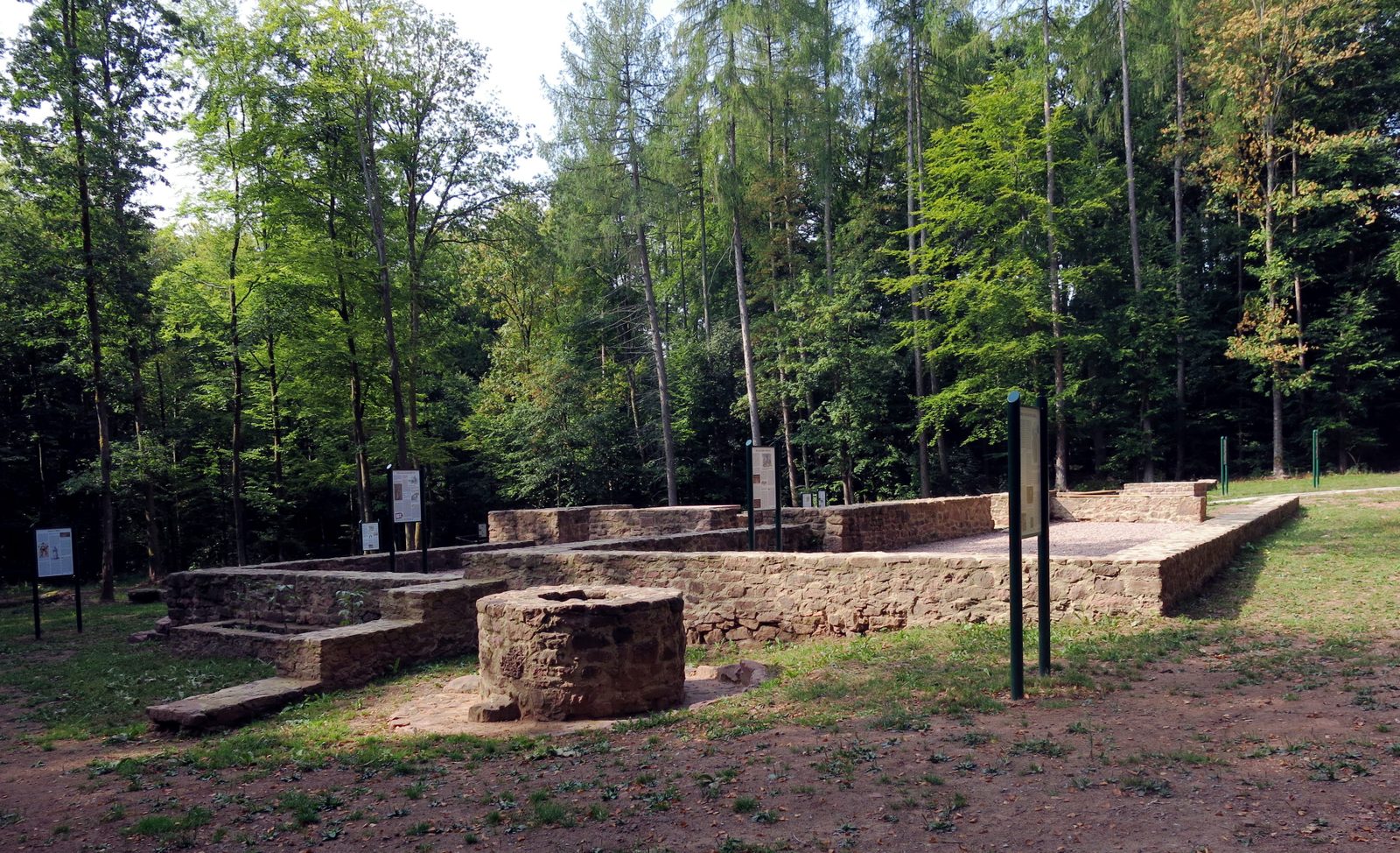
The Einsiedel Monastery (St. Elisabeth) (also referred to as Elisabethenzell Monastery) was a Premonstratensian monastery on the Birkenhainer Straße in the forest between Rieneck and Ruppertshütten in Bavaria in the Diocese of Würzburg.
History+
The farmstead of the Elisabethenzell Monastery was already mentioned in the 11th century. In the 13th century, after two previous buildings, there stood a church (23.5 × 8.5 m) founded by the Counts of Rieneck, which was endowed with income. It was handed over to the Premonstratensian Abbey of Oberzell in 1292 by Ludwig and Heinrich von Rieneck and Ulrich von Hanau. In 1326, the foundation was renewed. Adjacent was a 140 m2 cemetery enclosed by a stone wall with about 150 to 200 buried individuals. East and west of the monastery church stood two houses, one of them with warm-air heating. The mother monastery repeatedly sent new brothers to Rieneck in the 14th century, but ultimately the convent barely managed to sustain itself. The financial situation was tense. In 1350, St. Elisabeth became an outer court of the Abbey in Oberzell. In 1410, the monastery endowed this small abbey to two Dominicans for life. From this point on, reports about monastic life are missing. At the latest during the Reformation, the monastery was abandoned and the buildings fell into disrepair. Of the entire complex, only the chapel remained in the end. The bells are said to have gone to Schaippach and Ruppertshütten. In the Pfinzing map of 1594, the location of the monastery is still marked as Zum Ainsiegel. In 1617, there was a witch trial in which 17 women confessed under torture to having performed a witch dance at the site of the former monastery. In the 2000s, only a few piles of stones were visible from the medieval complex, and only field names and a later erected wayside shrine commemorated the monastery. In 2011, the area was surveyed with ground-penetrating radar; in 2012, excavations began under the scientific direction of the Archaeological Spessart Project, during which remains of a cistern and the old road Birkenhainer Straße were also found. Through extensive restorations in the following years, the floor plans of the monastery buildings were made visible again and an archaeological park with information boards was created.
Take Mobile History with you
You are reading this text for free. Premium adds what matters on the road: descriptions read aloud, sites found through your camera, whole regions taken offline.
- Every description, including the ~17,700 Premium sites
- Audio guide: have descriptions read to you on location
- AR finder: see sites through your camera, with distance and bearing
- Unlimited saved sites
14 days free, then from €2.99 a month. Cancel anytime.
Source: Wikipedia · Licence: CC BY-SA 4.0 · Image: Bonnlander · Wikimedia Commons · CC BY-SA 4.0
This description is a machine translation of an excerpt from the linked Wikipedia article. The source text was written by its authors, the translation is by Mobile History; like the original it is licensed under CC BY-SA 4.0.
Location: 50.0896, 9.5856