Estate, excursion destination, guesthouse, agriculture
MonasteryFischbach
Hofgut Retters in Kelkheim
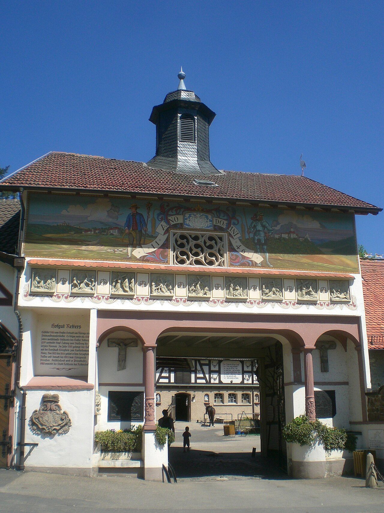
The Rettershof in the Main-Taunus district of Hesse is a historic estate whose origins trace back to a former Premonstratensian monastery. The complex, now a protected cultural monument, combines a long history as a spiritual center with later use as an agricultural enterprise, and today it is a popular excursion destination.
History+
The history of Rettershof began around 1136 with the settlement of canonesses from the Westerwald. In 1146, Count Gerhard von Nürings donated the lands for the establishment of a monastery. Although a document from 1245 mentions an Augustinian monastery, it is certain that Premonstratensians lived in Retters by 1272 at the latest. Originally conceived as a dual monastery for women and men, it evolved into a pure nunnery around 1200, whose members often came from the lower nobility. The monastery church was dedicated to the Blessed Virgin Mary. Nuns resided in Retters until 1559, after which the property was used as an estate by various owners.
Location+
The Rettershof is situated at an elevation of approximately 282 meters above sea level, northeast of Fischbach, a district of Kelkheim in the Vordertaunus region. The complex is located on the edge of the Retterswald forest in a wide valley of the Krebsbach stream, surrounded by agricultural fields to the west and extensive forests to the east.
On site+
Today, the Rettershof continues to be used for agriculture and serves as a regional excursion destination. Numerous hiking trails lead across the grounds, and an inn invites visitors to stop for refreshments.
Nearby+
- Rettershof Castle (Kelkheim) (Castle, approx. 119 m away)
- Königstein Castle Ruin (Castle, approx. 2629 m away)
- Luxembourg Castle (Königstein) (Castle, approx. 2719 m away)
- Nürings Castle Ruin (Castle, approx. 3957 m away)
Take Mobile History with you
You are reading this text for free. Premium adds what matters on the road: descriptions read aloud, sites found through your camera, whole regions taken offline.
- Every description, including the ~17,700 Premium sites
- Audio guide: have descriptions read to you on location
- AR finder: see sites through your camera, with distance and bearing
- Unlimited saved sites
14 days free, then from €2.99 a month. Cancel anytime.
Source: Wikipedia · Licence: CC BY-SA 4.0 · Image: ThomasPusch / CC BY-SA 4.0 via Wikimedia Commons
This description draws on the facts documented in the linked Wikipedia article; Wikipedia content is licensed under CC BY-SA 4.0. Wording and editing: Mobile History.
Location: 50.1691, 8.4305