ManorHalle (Saale)-Reideburg-Sagisdorf

Sagisdorf Manor
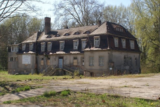
Sagisdorf Manor

Uninhabited

The Sagisdorf Manor, today located in Halle (Saale), was the seat of the noble families von Steinfurt, von Dieskau, von Rauchhaupt, and von Werder.

The Sagisdorf Manor is located in Reideburg, which is today a district of Halle in the south of the federal state of Saxony-Anhalt.

The manor is mentioned in the 14th century when its owner, Henning von Steinfurt, slew Albrecht von Dieskau. During the reconciliation of both families in 1358, Sagisdorf was transferred by Archbishop Otto to the family of Conrad von Dieskau. In 1476, Hans Rauchhaupt zu Hohenthurm took over the Sagisdorf Manor. Ownership changed several times between the related families von Rauchhaupt and von Werder until 1945. Hans Klaus von Werder, the last owner before 1945, transformed the 70-hectare estate into a flourishing agricultural enterprise that supplied the cities of Halle/Saale and Leipzig with fine fruit and early vegetables. Over one hectare of land was also placed under heated greenhouses here.

The von Werder family was dispossessed and expelled by the communists in 1945. The Sagisdorf estate briefly served as accommodation for the Red Army. Afterwards, it was occupied by refugees and displaced persons from the German eastern territories. In mid-1952, according to the SED party conference, the entire area was used as an LPG (Agricultural Production Cooperative); the manor house became the State Lupus Sanatorium of the University Dermatology Clinic Halle-Wittenberg. From June 1962, the rehabilitation center of the University Orthopedic Clinic Halle was housed in the manor house. The decay of the complex steadily progressed despite its use. In 1992, the clinic moved out. The building has been vacant ever since.

After the reunification, the surrounding coach houses and stables were demolished. All that remained of the manor was the manor house and the 2.5-hectare park, which was placed under landscape protection by the city of Halle in 1992. All other areas were designated as building land and developed with single-family homes.

Take Mobile History with you

You are reading this text for free. Premium adds what matters on the road: descriptions read aloud, sites found through your camera, whole regions taken offline.

  • Every description, including the ~17,700 Premium sites
  • Audio guide: have descriptions read to you on location
  • AR finder: see sites through your camera, with distance and bearing
  • Unlimited saved sites

14 days free, then from €2.99 a month. Cancel anytime.

Source: Wikipedia · Licence: CC BY-SA 4.0 · Image: Roland Neubert, Halle (Saale)

This description draws on the facts documented in the linked Wikipedia article; Wikipedia content is licensed under CC BY-SA 4.0. Wording and editing: Mobile History.

Location: 51.4884, 12.0432