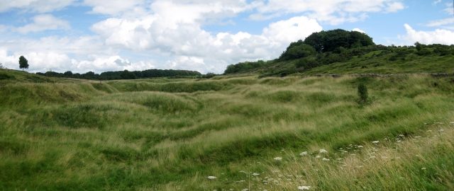
The remains of the roman town can be visited
Roman Town Iscalis

Charterhouse Roman Town was a town in the Roman province of Britannia. Its site is located just to the west of the village of Charterhouse-on-Mendip in the English county of Somerset.
Its Latin name may have been Iscalis, but this is far from certain. An alternative, based on inscriptions on a pig of Roman lead BRIT. EX. ARG. VEB, meaning "British (lead) from the VEB... lead-silver works" would suggest the name VEB for the site. This may explain the nearby village of Ubley, as V and U are interchangeable in Latin, Ubley may have derived from Veb-ley, and was originally a settlement where Romano-British lead miners lived.
The Roman landscape has been designated as a Scheduled Ancient Monument.
Mining settlement+
The settlement grew up around the north-western edge of prehistoric lead and silver mines, which were exploited by the Romans. Mendip lead ore had up to 0.4% silver content, which the Romans used to pay the army. Extraction is thought to have begun as early as AD 49 (although the evidence of dateable lead ingots found in the neighbourhood has recently been questioned.) At first the lead and silver industries were tightly controlled by the Roman military (in the south-west, by the Second Legion) and there was a small 'fortlet' adjoining the mines during the 1st century, which may, however, have been little more than a fortified compound for storing lead pigs. After a short time, the extraction of these metals was contracted out to civilian companies, probably because of low silver content. Smelting was undertaken on site where industrial workshops have been excavated, and the metal exported along a minor road to the Fosse Way, and probably through a small inland port at nearby Cheddar.
Amphitheatre+
An amphitheatre stood west of the settlement. It is the only one in England to exist at a lead mine and is additional evidence of the importance of Mendip lead to the Romans. It measures 32m x 24.4m and the banks for the seating survive 4.5m above the arena. It was surveyed in 1909. It was probably a place of entertainment for the soldiers at the Roman fort which was established here.
Take Mobile History with you
You are reading this text for free. Premium adds what matters on the road: descriptions read aloud, sites found through your camera, whole regions taken offline.
- Every description, including the ~17,700 Premium sites
- Audio guide: have descriptions read to you on location
- AR finder: see sites through your camera, with distance and bearing
- Unlimited saved sites
14 days free, then from €2.99 a month. Cancel anytime.
Source: Wikipedia · Licence: CC BY-SA 4.0
This description draws on the facts documented in the linked Wikipedia article; Wikipedia content is licensed under CC BY-SA 4.0. Wording and editing: Mobile History.
Location: 51.3054, -2.7203