The remains of the roman town can be visited
Ancient BuildingArchar (Арчар)
Roman City Ratiaria
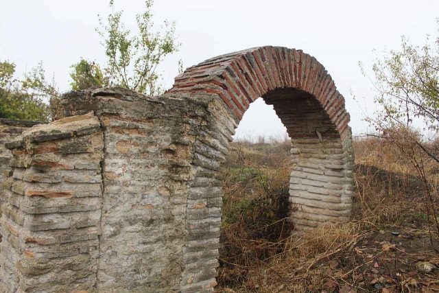
In Bulgaria, the remains of Ratiaria, a Roman city and fort in the province of Moesia, are found. As a component of the Danubian Limes and later as a provincial capital, it played a role in the Roman defense and administration of the region.
History+
The origins of Ratiaria date back to the Thracian period, possibly due to a gold mine in the area, which was attacked as early as 60 BC. The Roman garrison was founded at the beginning of the 1st century AD and developed into a base for the Danube fleet under Emperor Vespasian. Under Emperor Trajan, Ratiaria was elevated to Colonia Ulpia Ratiaria after the Dacian Wars, granting it the highest city rights status in the Roman Empire. After 272 AD, it became the capital of the province of Dacia ripensis, thus becoming the economic and strategic center of northwestern Bulgaria. In 441, the city was conquered and destroyed by the Huns under Attila, but was later rebuilt under the Byzantine emperors Anastasius I and Justinian I. The final destruction occurred in 586 by the Avars.
Location+
The ancient city of Ratiaria is located in Bulgaria, approximately two kilometers west of the village of Archar in the Dimovo municipality, Vidin Province.
On site+
The remains of the Roman city of Ratiaria can be visited today. Archaeological excavations have uncovered public buildings, cult houses, parts of the fortress wall and the western city gate, as well as remains of villas and necropolises. Inscriptions, sculptures, and mosaics are present.
Take Mobile History with you
You are reading this text for free. Premium adds what matters on the road: descriptions read aloud, sites found through your camera, whole regions taken offline.
- Every description, including the ~17,700 Premium sites
- Audio guide: have descriptions read to you on location
- AR finder: see sites through your camera, with distance and bearing
- Unlimited saved sites
14 days free, then from €2.99 a month. Cancel anytime.
Source: Wikipedia · Licence: CC BY-SA 4.0 · Image: http://de.wikipedia.org/wiki/Datei:Ratiaria_2010_094.JPG
This description draws on the facts documented in the linked Wikipedia article; Wikipedia content is licensed under CC BY-SA 4.0. Wording and editing: Mobile History.
Location: 43.8167, 22.9045