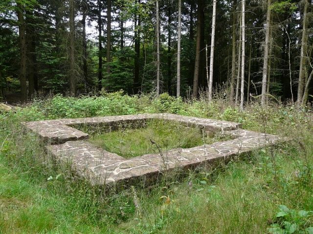
The remains of the roman Watchtower can be visited
Ancient BuildingMudau-Schloßau
Roman Watchtower 10/34
The Upper Germanic-Rhaetian Limes, with a length of 550 km, from Eining near Regensburg to Rheinbrohl on the Rhine, is the largest archaeological monument in Germany and has been recognized by UNESCO as a World Heritage Site. Limes (Latin: border path/wall) refers to the border fortifications of the Roman Empire, which were erected towards the end of the 1st century AD.
This border was monitored by more than 900 towers, which were built in timber construction during the initial phase, starting around 80 AD. Stone towers followed, which were plastered from 150 AD onwards. Excavations have shown that the white plaster often had incised joints, which were painted in terracotta. This created the impression of beautiful ashlar masonry.
Not far from the Limes wall is Wp 10/34 "Im Hohen Wald". The preserved stone tower ruin is visible. The wooden tower site was partially destroyed by a small modern quarry. At the beginning of the 19th century, excavations were carried out at this tower at the instigation of Count Franz von Erbach in search of "Roman antiquities". At Wp 10/34, a hand-hewn block bearing the inscription CHO I was unearthed. It was installed in the park of the Count in the base of a Limes watchtower (upside down) erected there. The inscription refers to the Cohors I Sequanorum et Rauracorum, which was stationed in the Oberscheidental fort. Their commander had to administer a longer section of the border and was also responsible for the construction of the towers located here.
Source: Wikipedia · Licence: CC BY-SA 4.0 · Image: http://de.wikipedia.org/wiki/Datei:Wp_10-34_Stein.jpg
This description draws on the facts documented in the linked Wikipedia article; Wikipedia content is licensed under CC BY-SA 4.0. Wording and editing: Mobile History.
Location: 49.5580, 9.1029