The roman Watchtower can be visited
Ancient BuildingRaitenbuch
Roman Watchtower 14/55
The Upper Germanic-Rhaetian Limes, with a length of 550 km from Eining near Regensburg to Rheinbrohl on the Rhine, is the largest archaeological monument in Germany and has been recognized by UNESCO as a World Heritage Site. Limes (Latin: border path/wall) refers to the border fortifications of the Roman Empire, which were erected towards the end of the 1st century AD.
This border was monitored by more than 900 towers, which were built in timber construction during the initial phase, starting around 80 AD. Stone towers followed, which were plastered from 150 AD onwards. Excavations have shown that the white plaster often had cracked joints, which were painted in terracotta. This created the impression of beautiful ashlar masonry.
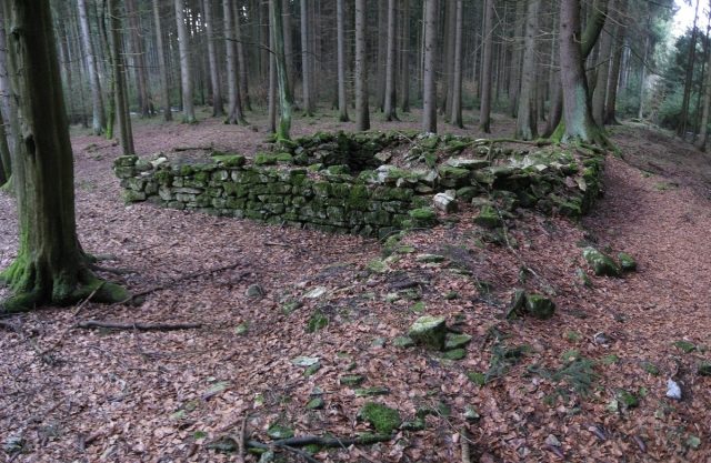
1.05 km from Wp 14/54, the 6.2 × 5.9 m large, somewhat dilapidated stone tower foundation is visibly preserved in the forest. The tower, with its 0.76 m thick walls, was already excavated, examined, measured, and drawn in 1789 by the ecclesiastical councilor and professor of mathematics, Ignaz Pickel (1736–1818) from Eichstätt. Tuff stones, which do not occur in this area, were found on the paved floor inside the tower.
Source: Wikipedia · Licence: CC BY-SA 4.0
This description draws on the facts documented in the linked Wikipedia article; Wikipedia content is licensed under CC BY-SA 4.0. Wording and editing: Mobile History.
Location: 48.9875, 11.1441