The roman Watchtower can be visited
Ancient BuildingHienheim
Roman Watchtower 15/46
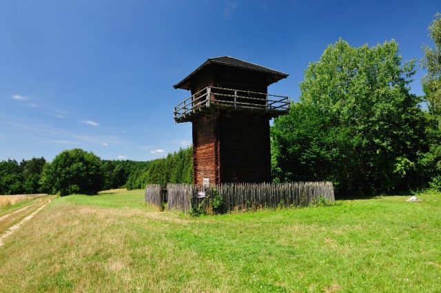
From Wp 15/34, the Limes runs in an easterly direction, gently sloping to the southeast. A slight bend can be seen at the now barely discernible remains of the 4.5 x 4.8 meter stone tower Wp 15/46. From there, the Raetian Wall was surveyed almost exactly on a west-east axis. As the Reichs-Limes-Kommission (RLK) was able to determine, the tower faced north. The Limes wall was subsequently built onto its northwestern and northeastern corners. About five meters west of the stone tower lay the older wooden tower mound, which is almost cut in half by the Limes wall. At Wp 15/46, a lookout tower built in rustic log construction was erected, which, however, has little in common with the wooden watchtowers that once stood on the Upper Germanic-Raetian Limes. From Wp 15/46, there was a line of sight to the watchtower on the Weinsberg on the right bank of the Danube to the south, and from there to the Eining fort.
Source: Wikipedia · Licence: CC BY-SA 4.0
This description draws on the facts documented in the linked Wikipedia article; Wikipedia content is licensed under CC BY-SA 4.0. Wording and editing: Mobile History.
Location: 48.8835, 11.7736