The remains of the Roman fort can be visited.
Ancient BuildingWürzberg - Eulbach
Roman Castle Eulbach
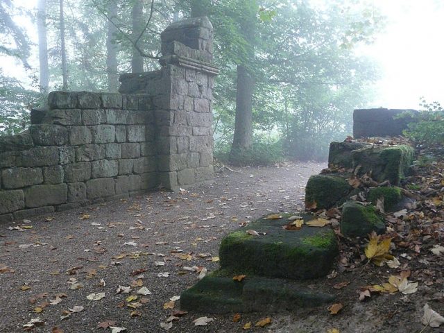
The Eulbach fort was a Roman Numerus fort of the older Odenwald line of the Neckar-Odenwald Limes. The present archaeological monument is located on the land of the hamlet of Eulbach in the east of the municipal area of Michelstadt in the Odenwaldkreis in Hesse.
The Eulbach fort is located in a forest between the Michelstadt districts of Vielbrunn and Würzberg. It lies there at an altitude of around 510 meters, on the ridge line of a north-south running mountain range. Federal road 47, which connects Michelstadt with Amorbach and reaches its highest point here, runs straight through the archaeological monument. About 250 meters east of the fort, state road L 3349 branches off from B 47 to the north in the direction of Vielbrunn. Assuming an unwooded foreland, the fort's garrison would have had a clear view of the eastern and southeastern valleys from here, almost to the Main, especially as the fort area was slightly sloped to the east and south. About 150 meters west of the former fort area is the Eulbach hunting lodge and Eulbach Park.
Research History+
After the Limes was moved forward around the year 159 and the associated abandonment of the camp, the Eulbach fort remained visible as a ruin for a long time. It is mentioned in documents at the beginning of the 9th and again in the 11th century. Later, the village of Eulbach was built in this area, but it was destroyed during the Thirty Years' War. In 1806, the fort was rediscovered during agricultural work and investigated and excavated by Johann Friedrich Knapp on behalf of Count Franz I zu Erbach-Erbach (1754–1823). At that time, one to two stone layers of the masonry were still present. The fort bath was located in 1889. The scientific archaeological excavation by the Reichs-Limeskommission (RLK) under the local excavation management of Friedrich Kofler in 1895 already had to ascertain extensive destruction of the fort area. The solid masonry had completely disappeared and the former shape of the camp had to be reconstructed solely on the basis of the foundation trenches and some rubble fillings.
Findings+
With its praetorial front, the fort was oriented to the east, towards the Limes running past at a distance of approximately 80 meters. The length (outer side) of the front was calculated at 71.13 meters, that of the rear front at 72.50 meters, the length of the left flank was estimated at 79.90 meters, and that of the right flank at 79.27 meters. This results in internal dimensions of approximately 70 × 78 meters, which corresponds to an area of around 5500 square meters. The thickness of the defensive wall was probably just under 1.10 meters, and it was made of white sandstone.
Source: Wikipedia · Licence: CC BY-SA 4.0
This description is a machine translation of an excerpt from the linked Wikipedia article. The source text was written by its authors, the translation is by Mobile History; like the original it is licensed under CC BY-SA 4.0.
Location: 49.6807, 9.0743