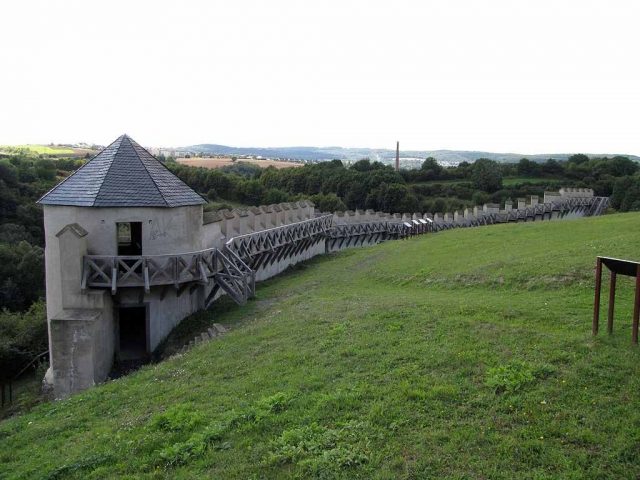
The remains of the roman Castle can be visited
Roman Castle Katzenberg

The Late Roman hilltop fortification Katzenberg, also known as Römerwarte Mayen, is a Roman refuge castle from the 4th century near Mayen. The fortification located on the Katzenberg was built around 300 AD, when the Roman Limes had been destroyed and Germanic tribes plundered into the Roman Empire (Limesfall). The inhabitants of the vicus at the site of modern-day Mayen could flee to the 1.2-hectare complex in times of danger. The provincial capitals Trier, Cologne, and Mainz received city walls during this period, as did smaller towns like Koblenz or Andernach. The Katzenberg was the largest of about 60 Late Roman hilltop fortifications that were built in the Eifel and Hunsrück regions. It was in use for about 70 years and, after a 30-year break, again until about 450 AD. On the uppermost peak of the mountain, there was a small military outpost, while the lower-lying open areas were probably available to the civilian population in case of alarm.
The remains of the Late Roman hilltop fortification were discovered around 1900 and first excavated between 1907 and 1932. After a long break, excavations resumed in 1997 as part of the Vulkanpark project. The finds were archaeologically investigated in cooperation with the city of Mayen and on behalf of the State Office for Monument Preservation in Koblenz.
For the history of craftsmanship, the finds of the roof covering are particularly important. The discovered roof slate tiles from the round towers surprisingly showed a scale shape, which was rare in Roman times.
In 2000, parts of the defensive wall and two round towers were reconstructed on original wall remains. A protective structure was erected on the remains of the former military station on the hilltop, which had underfloor heating. All roofs were again covered with roof slate in a scale shape and in hexagonal templates (protective structure).
Take Mobile History with you
You are reading this text for free. Premium adds what matters on the road: descriptions read aloud, sites found through your camera, whole regions taken offline.
- Every description, including the ~17,700 Premium sites
- Audio guide: have descriptions read to you on location
- AR finder: see sites through your camera, with distance and bearing
- Unlimited saved sites
14 days free, then from €2.99 a month. Cancel anytime.
Source: Wikipedia · Licence: CC BY-SA 4.0 · Image: http://de.wikipedia.org/wiki/Datei:Wehrmauer_R%C3%B6mische_H%C3%B6henbefestigung_Katzenberg_Mayen_2010.jpg
This description draws on the facts documented in the linked Wikipedia article; Wikipedia content is licensed under CC BY-SA 4.0. Wording and editing: Mobile History.
Location: 50.3200, 7.2439