The remains of the roman Castle can be visited
Ancient BuildingOsterburken
Roman Castle Osterburken
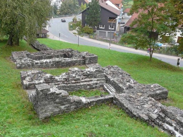
The Roman Fort of Osterburken, located in Osterburken, Baden-Württemberg, is a part of the UNESCO World Heritage Upper Germanic-Rhaetian Limes. It once served as an outpost for securing the “Vorderer Limes” (Front Limes). The complex, which was expanded into a double fort by a later annex, is now an archaeological reference point.
History+
The cohort fort was built on the banks of the Kirnau in a hill landscape that had already been settled in prehistoric times. Dendrochronological analyses of timbers from the Beneficiarius sanctuary date their felling to the winter of 159/160 AD. The cohort bath, whose oak posts were felled in late 164 AD, supports the assumption that the Vorderer Limes was expanded shortly after the death of Emperor Antoninus Pius in 161 AD. A Roman troop presence before 160 AD is considered unlikely. The annex fort, built between 185 and 192 AD, secured the previously threatened hillside and possibly housed the Numerus Brittonum Elantiensium, which was previously stationed together with the 3rd Aquitanian Cohort in Neckarburken.
Location+
The Roman Fort of Osterburken is located in the town of Osterburken in the Neckar-Odenwald district, Baden-Württemberg, Germany. It is situated at an elevation of approx. 263 m above sea level.
Take Mobile History with you
You are reading this text for free. Premium adds what matters on the road: descriptions read aloud, sites found through your camera, whole regions taken offline.
- Every description, including the ~17,700 Premium sites
- Audio guide: have descriptions read to you on location
- AR finder: see sites through your camera, with distance and bearing
- Unlimited saved sites
14 days free, then from €2.99 a month. Cancel anytime.
Source: Wikipedia · Licence: CC BY-SA 4.0 · Image: http://de.wikipedia.org/wiki/Datei:ORL_40_Annexkastell_Osttor_2.JPG
This description draws on the facts documented in the linked Wikipedia article; Wikipedia content is licensed under CC BY-SA 4.0. Wording and editing: Mobile History.
Location: 49.4270, 9.4248