Ancient BuildingWallsend

Roman Fort Segedunum (Milecastle 0)
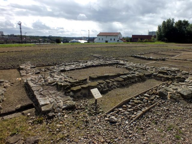
Roman Fort Segedunum (Milecastle 0)

The remains of the roman Castle can be visited

Milecastle 0 is a possible milecastle of the Roman Hadrian's Wall which may have preexisted the fort of Segedunum. Although its existence has been suggested by historian Peter Hill, no evidence of this milecastle has been found. It is not known whether the decision to establish forts on the line of the wall predated the decision to extend the wall to Wallsend, so it is possible that this milecastle was never built.

Construction+

Nothing is known of the construction of Milecastle 0.

Excavations and investigations+

No excavations or investigations have taken place specifically for Milecastle 0. No evidence has been found during excavation of Segedunum.

Associated Turrets+

Each milecastle on Hadrian's Wall had two associated turret structures. These turrets were positioned approximately one-third and two-thirds of a Roman mile to the west of the Milecastle, and would probably have been manned by part of the milecastle's garrison. The turrets associated with Milecastle 0 are known as Turret 0A and Turret 0B.

Turret 0A

Nothing is known of this Turret.

Turret 0B

Turret 0B (St Francis) is located east of St Francis Community Centre. It was first noted by John Horsley in 1732 who mistook it for Milecastle 1, and it is sometimes referred to as Horseley's Milecastle 1.
Eric Birley (still understanding it to be Milecastle 1) considered that it was rediscovered by Canon Fowler in 1877, and the structure was also recorded (and identified as a Turret) by John Collingwood-Bruce and Robert Blair , when it was discovered during the digging for foundations of 'The Grange'. The Turret was confirmed as such by Grace Simpson with reference to an article in The Evening Chronicle on 15 August 1936, which described an extension of Stotts Road, Walker which cut through 'the Roman Wall and one of its turrets near the Grange'. The turret's stones were later removed to Carville Chapel grounds to form rock gardens.

Take Mobile History with you

You are reading this text for free. Premium adds what matters on the road: descriptions read aloud, sites found through your camera, whole regions taken offline.

  • Every description, including the ~17,700 Premium sites
  • Audio guide: have descriptions read to you on location
  • AR finder: see sites through your camera, with distance and bearing
  • Unlimited saved sites

14 days free, then from €2.99 a month. Cancel anytime.

Source: Wikipedia · Licence: CC BY-SA 4.0 · Image: Ozymandias

This description draws on the facts documented in the linked Wikipedia article; Wikipedia content is licensed under CC BY-SA 4.0. Wording and editing: Mobile History.

Location: 54.9878, -1.5322