Ancient BuildingFahrenbach

Roman Castle Robern
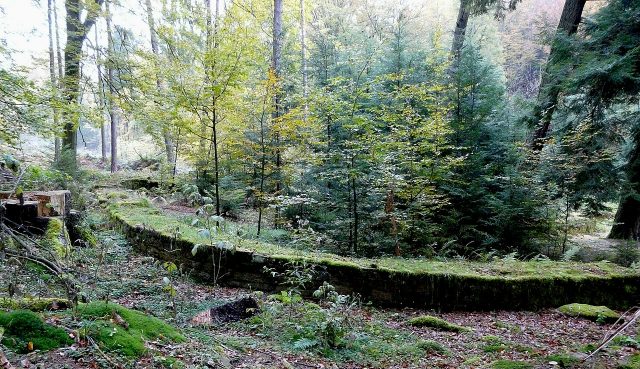
Roman Castle Robern

The remains of the roman Castle can be visited


The small fort of Robern, also known as Hönehaus or Hönenhaus, was a Roman border fort on the older Odenwald line of the Neckar-Odenwald Limes in the municipality of Fahrenbach in the Baden Neckar-Odenwald district.

Location and Research History+

The present-day archaeological monument is located in the "Kapellenwald" (Chapel Forest) between the Limbach district of Wagenschwend and the Fahrenbach district of Robern. It lies at the foot of a relatively steep slope, in an area where it flattens out a little.

In older literature and popular parlance, the small fort is also called Hönehaus or Hönenhaus, but it should not be confused with the fort of the same name, Kastell Hönehaus, on the Younger Odenwald line of the Upper Germanic-Raetian Limes. In local folklore, the former Roman garrison played a certain role in some legends.

After the fort had suffered some loss of substance in the Middle Ages and modern times due to the fact that it served as a convenient quarry for Robern and Wagenschwend, it was archaeologically investigated and documented in May 1893 by the Imperial Limes Commission under the direction of the responsible section commissioner Karl Schumacher.

Today, the foundations of the fort are preserved and publicly accessible.

Findings+

The commission's excavations uncovered a fortification of only about 400 square meters, which had previously been considered a watchtower (Wp 10/48). However, it was a two-gated stone fort with a slightly shifted square ground plan of 20 m side length. The stone rampart had strongly rounded corners and was built entirely of red sandstone. The thickness of the rising masonry, which rested on a foundation of smaller sandstone blocks, was 95 cm to 104 cm. At the base of the rising wall was a 14 cm to 18 cm high, bevelled projecting plinth course. Originally, the wall was covered with a white mortar plaster with painted red false joints.

The main entrance of the two-gated complex was towards the Limes, on the east side of the fort. It was 2.96 m wide and flanked by 91 cm to 98 cm thick, recessed gate cheeks. From the gate, a three-meter-wide path with a stone paving led, which crossed the Limes accompanying path, which was five meters wide at this point, and led to a spring. The second gate on the westward-facing decuman side (rear side) of the camp consisted of a simple passage only 1.71 m wide. There was no defensive ditch.

Inside the fortification, there were no stone buildings, but, as evidenced by the clay fragments found, only half-timbered structures. Nothing is known about the garrison, presumably a vexillatio of a larger auxiliary unit. Some cornice and capstones as well as a relief of Victoria originate from the fort.

Take Mobile History with you

You are reading this text for free. Premium adds what matters on the road: descriptions read aloud, sites found through your camera, whole regions taken offline.

  • Every description, including the ~17,700 Premium sites
  • Audio guide: have descriptions read to you on location
  • AR finder: see sites through your camera, with distance and bearing
  • Unlimited saved sites

14 days free, then from €2.99 a month. Cancel anytime.

Source: Wikipedia · Licence: CC BY-SA 4.0 · Image: http://de.wikipedia.org/wiki/Datei:200910260951MEZ_KK_Robern_06.jpg

This description draws on the facts documented in the linked Wikipedia article; Wikipedia content is licensed under CC BY-SA 4.0. Wording and editing: Mobile History.

Location: 49.4664, 9.1599