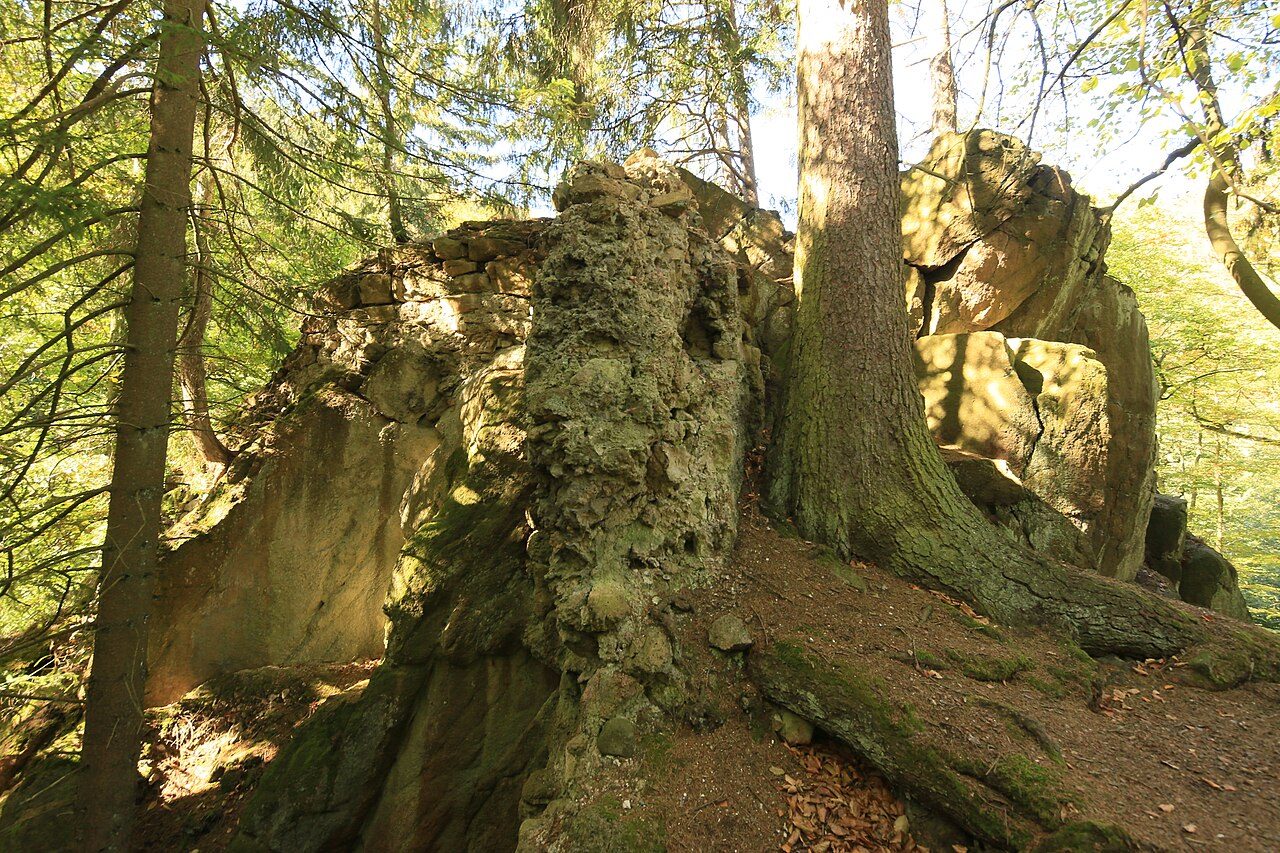
The remains of the Castle can be visited
Ahlsburg Castle (Ruin) (Ilsenburg)

Geographical Location+
The site of the former Ahlsburg is located about 4.5 km south-southwest of Stapelburg and 4 km north-northeast of the Eckertalsperre on the northern edge of the Harz mountains. It lies above the right or eastern bank of the Ecker, a southeastern tributary of the Oker that forms the state border with the western neighboring Lower Saxony. The castle stood above a narrow point in the valley, where a pedestrian bridge crosses the Ecker, on a mountain spur with steeply sloping granite cliffs.
Alardus von Burgdorf, mentioned in 1218, is associated with the Ahlsburg, especially since his descendants are still mentioned there in the 14th century. The castle was first documented in 1357 as Alerdestein, when Emperor Charles IV enfeoffed Alard the Elder and Alard the Younger von Burgdorf with 1 1/2 Hufen near Wollingerode, which belonged to the Alerdestein. It belonged to the imperial estate and the Palatinate of Werla. In the early modern period, the castle fell into ruin. Its possession passed to the Counts of Stolberg.
The lords of the castle were responsible for the protection of the surrounding imperial ban forest.
Later, the former inner-German border ran through the birch pioneer forest. Next to a right turn in the former patrol road, there is, among other things, a sign "Ahlsburg", to which one walks about 100 m uphill from the Ecker.
Today, only a few remains of the Ahlsburg walls are left.
Take Mobile History with you
You are reading this text for free. Premium adds what matters on the road: descriptions read aloud, sites found through your camera, whole regions taken offline.
- Every description, including the ~17,700 Premium sites
- Audio guide: have descriptions read to you on location
- AR finder: see sites through your camera, with distance and bearing
- Unlimited saved sites
14 days free, then from €2.99 a month. Cancel anytime.
Source: Wikipedia · Licence: CC BY-SA 4.0 · Image: Uwe-Chico / CC BY-SA 4.0 via Wikimedia Commons
This description draws on the facts documented in the linked Wikipedia article; Wikipedia content is licensed under CC BY-SA 4.0. Wording and editing: Mobile History.
Location: 51.8675, 10.6209