The remains of the Castle can be visited
CastleWehrda
Altwehrda Castle (Ruin) (Wehrda)
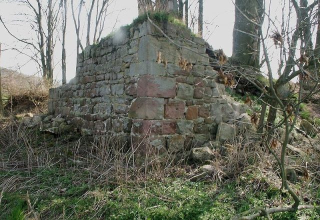
The Altwehrda ruin, once a complex, is situated in the landscape of Wehrda in the Hersfeld-Rotenburg district in Hesse.
History+
The exact construction date of Altwehrda Castle is unknown. It was first documented in 1308 when Abbot Heinrich V, Count of Weilnau, pledged the property to the ministerial family von Trümbach. Two years later, in 1310, the von Trümbach family received the castle as a fief. It is believed that Altwehrda was the original ancestral seat of this family. In 1483, the castle served as a refuge for the Neukirchen court. It was still inhabited in the 15th century but was destroyed around 1637 during the Thirty Years' War and not rebuilt thereafter.
Location+
The Altwehrda ruin is located at an altitude of approximately 241 meters above sea level in Wehrda.
Want to learn more about this site?
The full description is available with Premium — plus offline packages, audio guide and high-resolution images.
- Every description, including the ~17,700 Premium sites
- Audio guide: have descriptions read to you on location
- AR finder: see sites through your camera, with distance and bearing
- Unlimited saved sites
14 days free, then from €2.99 a month. Cancel anytime.
Already Premium and still locked?
Sign-in works per address. On mobilehistory.app you need to sign in once separately — your Premium then applies here too.
Sign in →Source: Wikipedia · Licence: CC BY-SA 4.0
This description draws on the facts documented in the linked Wikipedia article; Wikipedia content is licensed under CC BY-SA 4.0. Wording and editing: Mobile History.
Location: 50.7450, 9.6683