The remains of the Castle can be visited
CastleBubendorf
Gutenfels Castle (Ruin)
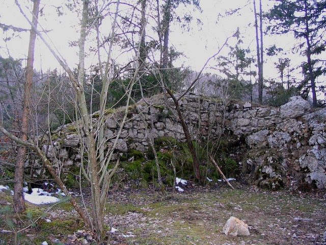
The former hilltop castle Gutenfels Ruin lies in the forests of Bubendorf in the canton of Basel-Landschaft, Switzerland, on a rock.
History+
The construction of Gutenfels Castle is attributed to the Lords of Eptingen, based on ceramic finds, and is dated to the period between 1220 and 1250. Its first documented mention occurred in 1303, when a Peter von Eptingen bore the epithet Gutenvelse. The Eptingers held the castle as a fief from the Frohburgers. After Peter's death in 1325, Count Johans von Frohburg seized the castle in 1326 as an expired fief and pledged it to Thüring von Ramstein. It is assumed that the castle was abandoned at this time, as it was already deserted before the Basel earthquake of 1356 and was probably completely destroyed and not rebuilt by this event. Nevertheless, Hans and Ulrich von Eptingen acquired the ruin in 1392 as their own property, as the associated lands and rights still held economic value. In 1411, the Eptingers sold the ruin, along with its goods and rights, to the city of Basel, which established a customs post there. In the 20th century, several archaeological investigations took place, including a private excavation in 1936 and systematic excavations in the 1960s by Karl Heid. In the summer of 2010, the ruin was uncovered and conserved by Andreas Loosli.
Location+
The Gutenfels Ruin is located in Bubendorf, a town in the Liestal district in the canton of Basel-Landschaft, Switzerland. It stands at an elevation of approx. 502 meters above sea level.
Take Mobile History with you
You are reading this text for free. Premium adds what matters on the road: descriptions read aloud, sites found through your camera, whole regions taken offline.
- Every description, including the ~17,700 Premium sites
- Audio guide: have descriptions read to you on location
- AR finder: see sites through your camera, with distance and bearing
- Unlimited saved sites
14 days free, then from €2.99 a month. Cancel anytime.
Source: Wikipedia · Licence: CC BY-SA 4.0
This description draws on the facts documented in the linked Wikipedia article; Wikipedia content is licensed under CC BY-SA 4.0. Wording and editing: Mobile History.
Location: 47.4225, 7.7269